GIS24.net
Geographic Information System
POI database from MEINWOMOmaps


Geographic Information System
POI database from MEINWOMOmaps
Europoort
/
ADDRESS
WeiterUrl : https:/ / de.wikipedia.org/ wiki/ Europoort
UrlLoad : https:/ / yes
WikiText : Der Europoort ist ein rund 3.700 Hektar großes Hafen- und Industriegebiet und bildet einen Teil des Rotterdamer Hafens. Er geht von Rotterdam bis zur Mündung der Maas in die Nordsee (40 km). Er liegt südlich des Nieuwe Waterweg an der Mündung des Calandkanals in die Nordsee. Zusammen mit dem Botlek, einem Gebiet mit ähnlicher Nutzung weiter östlich, ist der Europoort der größte Hafen für Petrochemie weltweit. Der Rotterdamer Hafen selbst war bis 2004 der größte Seehafen der Welt und ist momentan der mit Abstand größte Europas.
Click for interactive map
..
Pictures of the Poi and surroundings
.
Things to see in the area
4e Petroleumhaven
[ click for more information ]Molecaten Park Kruininger Gors
ACSI - Price ⬠14, open from 30open April - September
[ click for more information ]
5e Petroleumhaven
[ click for more information ]Maeslantwehr
[ click for more information ]Parkenprivat
[ click for more information ]Rotterdam-Europoort
[ click for more information ]Hoek van Holland Haven
[ click for more information ]Freibad
Zwembad Hook of Holland Rotterdam[ click for more information ]
ALDI
[ click for more information ]Lidl Hoek Van Holland
[ click for more information ]Wohnmobilparkplatz Koningin Sophieweg
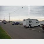 Large, free sand/gravel area behind the shore boulevard.
 [ click for more information ]