GIS24.net
Geographic Information System
POI database from MEINWOMOmaps


Geographic Information System
POI database from MEINWOMOmaps
Sarner Aa
/
ADDRESS

WeiterUrl : https:/ / de.wikipedia.org/ wiki/ Sarner Aa
UrlLoad : https:/ / yes
WikiText : Vorlage:Infobox Fluss/GKZ_fehltVorlage:Infobox Fluss/QUELLHHE_fehltVorlage:Infobox Fluss/HHENUNTERSCHIED_fehltVorlage:Infobox Fluss/EINZUGSGEBIET_fehltVorlage:Infobox Fluss/ABFLUSS_fehltVorlage:Infobox Fluss/KARTE_fehlt Oberlauf der Sarner Aa: Lauibach Die Sarner Aa ist ein 28 km langer Zufluss des Vierwaldstättersees im Kanton Obwalden, in der Zentralschweiz.
Click for interactive map
..
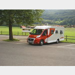
Pictures of the Poi and surroundings
.
Things to see in the area
Arniseeli
Der kleine Bergsee liegt auf einer Höhe von 1890 Metern.[ click for more information ]
Lauifall
Der Lauifall ist der höchste Wasserfall in Obwalden und hat eine Fallhöhe von 150 Metern.[ click for more information ]
Fluonalp
The Fluonalp is at the foot of the Giswilerstock above Giswil at 1538m.[ click for more information ]
Eisee
Der See liegt am Fusse des Brienzer Rothorns im Skigebiet Sörenberg auf einer Höhe von 1895 Metern.[ click for more information ]
Glaubenbielen, 1611 m
The Faith Bielen is a pass at 1611 m that connects Giswil in the canton of Obwalden with Flühli in the canton of Lucerne.[ click for more information ]
Parkplatz Glaubenbielen
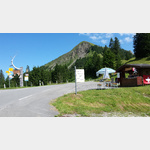 Overnight stay in a great parking lot.
 [ click for more information ]
Parkplatz Freilichtmuseum Ballenberg
 In the parking lot of the open-air museum.
 [ click for more information ]
Wyssensee
Der Wyssensee liegt auf dem Gebiet der Gemeinde Hofstetten bei Brienz.[ click for more information ]
Gasthaus Brünig Kulm
Das Gasthaus liegt unweit des Brünigpasses.[ click for more information ]
Mörlisee
Auf der Karte als Mörlisee, nicht Merlisee.[ click for more information ]
Brünigpass, 1008 m
The Brünig Pass connects the Haslital in the Bernese Oberland (BE) with the Sarneraatal in the canton of Obwalden (OW).[ click for more information ]
Dundelbachfälle
Kurz bevor der Dundelbach den Talboden erreicht, schiesst er über die beiden prächtigen Dundelbachfälle.[ click for more information ]
Naturfreundehaus Brünig
Das Naturfreundehaus Brünig liegt etwas unter dem Brünigpass auf rund 970 m, eingebettet in einer idyllischen Waldlichtung.[ click for more information ]
Jäägglisglunten
Der kleine Jääglisglunten befindet sich in der Gemeinde Brienz (Kanton Bern) auf 565 Metern.[ click for more information ]
Funtenensee
Der Funtenensee ist ein Baggersee in der Gemeinde Meiringen im Berner Oberland.[ click for more information ]
Parkplatz Seestrasse 891B
The parking lot is right on the lake along the Seestrasse (small, little-used access road to the Aaregg campsite).[ click for more information ]