GIS24.net
Geographic Information System
POI database from MEINWOMOmaps


Geographic Information System
POI database from MEINWOMOmaps
Kaitersberg
/
ADDRESS
93474 ArrachA10
WeiterUrl : https:/ / de.wikipedia.org/ wiki/ Kaitersberg
UrlLoad : https:/ / yes
WikiText : Der Kaitersberg ist ein bis zu 1.132 m hoher Bergkamm im Bayerischen Wald östlich von Bad Kötzting. Der langgezogene Höhenzug setzt sich nach Osten bis zum Arber fort. Höchster Gipfel des Bergrückens ist der 1132 m hohe Große Riedelstein mit dem Waldschmidt-Denkmal. Am Mittagstein (1034 ,m) befindet sich die Kötztinger Hütte. Weiter als bizarre Felsformationen aus Gneis herausragende Gipfel sind der Kreuzfelsen (999 ,m) mit Gipfelkreuz und die Rauchröhren (1044 ,m). Unterhalb des Kreuzfelsen befindet sich die Räuber-Heigl-Höhle, das Versteck von Michael Heigl aus Beckendorf, der hier im 19. Jahrhundert die Gegend unsicher machte. Die Rauchröhren bieten ein anspruchsvolles Klettergebiet bis zum elften Grad. Der dort gelegene Steinturm gilt als schwierigster Bayerwaldgipfel (IV).
Click for interactive map
..
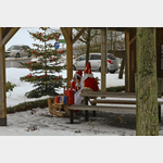
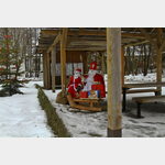
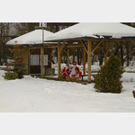
Pictures of the Poi and surroundings
.
Things to see in the area
Großer Riedelstein 1132 m
[ click for more information ]Kleiner Riedenstein
[ click for more information ]Wohnmobilparkplatz Eck
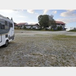 Large car park
usable 1 January - 31 December
[ click for more information ]
Goldsteig, Nordroute 13 Eck Großer Arber
The hiking trail leads through the Bavarian Forest and the Upper Palatinate Forest.[ click for more information ]
Kötztinger Hütte
2215543_Beschreibung[ click for more information ]
Landgasthof Gutshof Schmidt
Lamer Strasse 8, 93480 Hohenwarth, Germany[ click for more information ]
Glasdorf Weinfurtner
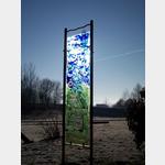 The Glass Village is an exhibition park with all kinds of sculptures made of glass.
 [ click for more information ]
Kirche
Parish Church of St Wolfgang Arrach[ click for more information ]
Schule
Arrach elementary school[ click for more information ]
Schloss Hohenwart
Around 1650, the four-wing complex was built, which was greatly changed in appearance by conversions.[ click for more information ]
kleiner Supermarkt
supermarket[ click for more information ]