GIS24.net
Geographic Information System
POI database from MEINWOMOmaps


Geographic Information System
POI database from MEINWOMOmaps
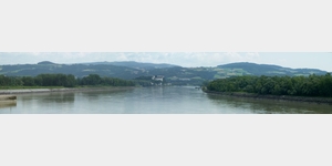
Kraftwerk Ottensheim-Wilhering
/
ADDRESS
 4100 Gemeinde Ottensheim
WeiterUrl : https:/ / de.wikipedia.org/ wiki/ Kraftwerk Ottensheim-Wilhering
UrlLoad : https:/ / yes
WikiText : Donaukraftwerk Ottensheim-Wilhering Das Kraftwerk Ottensheim-Wilhering ist ein Laufkraftwerk in der Donau zwischen den beiden oberösterreichischen Gemeinden Ottensheim und Wilhering. Dieses österreichische Donaukraftwerk wurde 1970-1974 errichtet. Da die Grenzen zwischen Ottensheim und Wilhering zu einer Zeit fest gelegt wurden, als die Donau noch nicht reguliert war, befindet sich das Kraftwerk Ottensheim-Wilhering in Wirklichkeit fast ausschließlich auf Ottensheimer Gemeindegebiet, da bis kurz hinter dem Kraftwerk die gesamte Breite der Donau sowie ein Teil südlich der Donau (Marktau) zu Ottensheim gehören. Lediglich ein Teil des Umspannwerkes, südlich der Donau, liegt auf Wilheringer Gemeindegebiet.
Click for interactive map
..
Pictures of the Poi and surroundings
Videos about the Poi and the surrounding area
.

.
Things to see in the area
[ click for more information ]
Umsetzanlage
[ click for more information ]Camping Kaltenböck
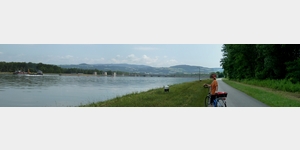
 Very nice, pleasant place right on the Danube Cycle Path, ideal for cyclists
is open 1 January - 31 December
[ click for more information ]
Regatta Restaurant
A parking lot on the Danube Cycle Path and a restaurantis usable January - December
[ click for more information ]
Landgasthof Rodlhof
A nice rural inn with good traditional cooking and (in summer) garden.[ click for more information ]
Friedhof Schonering
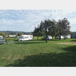
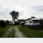
[ click for more information ]Wohnmobilstellplatz Camping Hofmühle
 A mobile home parking space for 48 mobile, which is cared for by the opposite campsite
is usable 1 January - 31 December
[ click for more information ]
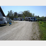
Camping Hofmühle
 Unspoilt Camping at an inn, Warm Kitchen 17:00 to 22:00
is open 1 January - 31 December
[ click for more information ]
Schloss Ottensheim
In 1148 Burg was first mentioned with the owners Ulrich and Cholo von Wilhering.[ click for more information ]
Pfarrkirche St. Ägidius
The 72m high tower with its slim copper pointed helmet is visible from afar.[ click for more information ]
Faehre
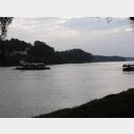 Car ferry Ottensheim - Wilhering in operation all year round
[ click for more information ]
Sportplatz
On the Danube Cycle Path.[ click for more information ]
sonstiges
Pink gas station[ click for more information ]
Stift Wilhering
The Lords of Wilhering founded the monastery in 1146.[ click for more information ]