GIS24.net
Geographic Information System
POI database from MEINWOMOmaps


Geographic Information System
POI database from MEINWOMOmaps
Gernot-Röhr-Biwak
/
ADDRESS
 9981 Kals am Großglockner
WeiterUrl : https:/ / de.wikipedia.org/ wiki/ Gernot-Röhr-Biwak
UrlLoad : https:/ / yes
WikiText : Das Gernot-Röhr-Biwak befindet sich auf dem Kesselkees-Sattel 2.926 ,m ,ü. ,A., nahe dem Bösen Weibl direkt am Wiener Höhenweg Steig Nr. ,713 / 918 zwischen Glorerhütte und Elberfelder Hütte. Die Biwakschachtel bietet ca ,6 - 8 Personen Platz zum bernachten. Die Biwakschachtel wurde 1973 von der AV-Jugend Lienz errichtet und nach ihrem Bergkameraden Gernot Röhr benannt, der am 11. Juni 1966 am Kleinen Laserzkopf in den Lienzer Dolomiten zu Tode stürzte.[1]
Click for interactive map
..
Pictures of the Poi and surroundings
.
Things to see in the area
Böses Weibl
[ click for more information ]Roter Knopf
[ click for more information ]Glorerhütte (2.642 m)
[ click for more information ]Kastenegg
[ click for more information ]Hintere Langtalsee
[ click for more information ]Tages Wanderparkplatz Lucknerhaus
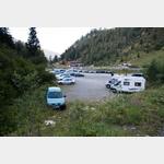 The hiking car park is the starting point for excellent hikes in the Glockner area.
 [ click for more information ]
Salmhütte (2644m)
More information at: https://www.[ click for more information ]