GIS24.net
Geographic Information System
POI database from MEINWOMOmaps


Geographic Information System
POI database from MEINWOMOmaps
Freilichtspiele Altusried
/
ADDRESS
87452 Altusried, KäferlohIm Tal
WeiterUrl : https:/ / de.wikipedia.org/ wiki/ Freilichtspiele Altusried
UrlLoad : https:/ / yes
WikiText : Die Freilichtspiele Altusried sind eine alle drei bis vier Jahre stattfindende Freiluft-Theaterveranstaltung in Altusried mit über 125-jähriger Tradition. Im Jahr 1879 wurde von Altusrieder Laiendarstellern erstmals das Stück Der bayerische Hiasl auf die Bühne gebracht. 1911 waren bereits 500 Gemeindemitglieder beteiligt, den Freiheitskampf Andreas Hofers szenisch darzustellen. Das Thema Freiheit und Kampf gegen Unterdrückung blieb bis heute das beherrschende Leitmotiv der Theateraufführungen. Seit 1952 wurde für die Freilichtspiele das Areal am Riedbach genutzt. 1993 wurde das Gelände von der Gemeinde Altusried gekauft. 1997 begann der Ausbau des Festspielgeländes mit moderner Ton- und Lichttechnik und dem Bau einer festen Zuschauertribüne. 1999 wurde die neue Freilichtbühne erstmals bespielt.
Click for interactive map
..
Pictures of the Poi and surroundings
.
Things to see in the area
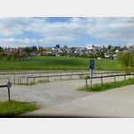
Parkplatz "Im Tal"
Alternative space to the official parking space ID 244423.[ click for more information ]
Restaurant Rosinante
Delicious Spanish cuisine at reasonable prices.[ click for more information ]
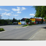
Open-air car park
 Alternative parking space to parking space 2444423 POI if it is full
is open January - December
[ click for more information ]
Wohnmobilstellplatz Altusried Freibad
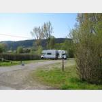 Parking lot at the heated outdoor pool, slightly sloping, hardly any shade, quiet location in the countryside, supply and disposal via a St-San station, power station with 6 connections
usable January - December
[ click for more information ]
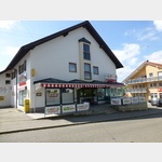
Apotheke
Andreas Hofer Pharmacy.[ click for more information ]
sonstiges
 Food market in the center of Altusried.
 [ click for more information ]
St.Blasius
St Blaise Altusried[ click for more information ]
Parkplatz im Zentrum
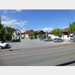 Parking in the center of Altusried.
 [ click for more information ]
Oberallgäuer Rundwanderweg 1
The Oberallgäu circular hiking trail is an approximately 200 km long circular hiking trail through beautiful landscapes and places worth seeing.[ click for more information ]
Gasthof zur Sonne
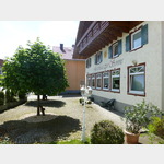 Allgäu and international delicacies.
[ click for more information ]
Gasthof "zum Bären"
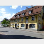 Allgäu specialty made from Allgäu products.
[ click for more information ]
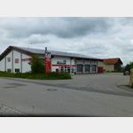
Rewe
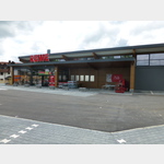 New food market with bakery and butcher
[ click for more information ]
Aral
Aral petrol station with kiosk.[ click for more information ]
Netto
 Supermarket with bakery.
 [ click for more information ]
Reifen Ohneberg
 Tires without mountain - if there is a problem with the tires.
 [ click for more information ]
Feuerwehr
Altusried Volunteer Fire Department[ click for more information ]
Landgasthaus zur fröhlichen Aussicht
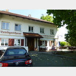 Popular place for excursions, especially for cyclists.
 [ click for more information ]
Wanderparkplatz Ruine Kalden
Wanderparkplatz an der Ruine Kalden und Blick auf den Illerdurchbruch und die "blaue Brücke" (Hängebrücke).[ click for more information ]