GIS24.net
Geographic Information System
POI database from MEINWOMOmaps


Geographic Information System
POI database from MEINWOMOmaps
ât Horntje
/
ADDRESS
WeiterUrl : https:/ / de.wikipedia.org/ wiki/ ât Horntje
UrlLoad : https:/ / yes
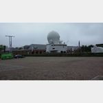
WikiText : t Horntje ist ein Fischerdorf auf der niederländischen Insel Texel (Noord-Holland). Texel ist die größte der fünf Inseln an Hollands Nordseeküste. t Horntje ist ein kleines Dorf mit wenigen Einwohnern, ist aber sehr wichtig für den täglichen Fährbetrieb von Den Helder zum Veerhaven, welcher sich in t Horntje befindet. Jeder, der die Fähre in Den Helder betritt und sie auf Texel wieder verlässt, kommt zwangsläufig an diesem kleinen, aber sehr schönen Fischerdorf vorbei. Das Royal Netherlands Institute for Sea Research (NIOZ) (Königlich-Niederländisches Institut für Meeresforschung) hat seinen Sitz am Fährhafen in t Horntje.
Click for interactive map
..
Pictures of the Poi and surroundings

Videos about the Poi and the surrounding area
.
.
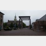
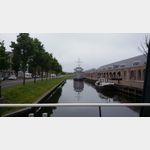
Things to see in the area
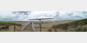
Fähre von Texel zum Festland
[ click for more information ]ParkenAll
[ click for more information ]ParkenAll
[ click for more information ]Bauernhofcamping Amalia
A beautifully located campsite with a cattle farmeris open 15 March - 1 November
[ click for more information ]
Mok
[ click for more information ][ click for more information ]
Parkenwander
[ click for more information ]ParkenAll
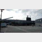
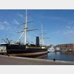
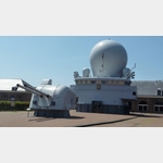
[ click for more information ]Marinemuseum
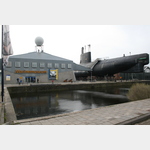 Here, a submarine are committed.
[ click for more information ]
Faehre
Ferry to Texel Havenplein 3, 1781 Den Helder, The Netherlands In Den Helder you buy the ticket for the ferry.[ click for more information ]
TouristInfo
Tourist information Den Helder[ click for more information ]