GIS24.net
Geographic Information System
POI database from MEINWOMOmaps


Geographic Information System
POI database from MEINWOMOmaps
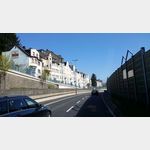
Koblenz-Karthause
/
ADDRESS
56073 Koblenz, MoselweißSandgaßweg
WeiterUrl : https:/ / de.wikipedia.org/ wiki/ Koblenz-Karthause
UrlLoad : https:/ / yes
WikiText : Die Karthause ist der größte Stadtteil von Koblenz. Er liegt im Süden von Koblenz auf etwa 174 m Höhe und ist der nördlichste Ausläufer des Hunsrücks zwischen den Flüssen Rhein und Mosel. Der Name des Berges, auf dem sich der Stadtteil befindet, wurde durch den Orden der Kartäuser geprägt. Der größte Teil des Stadtteils umfasst den Koblenzer Stadtwald mit dem Naherholungsgebiet Remstecken und dem Fernmeldeturm Koblenz auf dem 382 m hohen Kühkopf. Außerdem befindet sich in diesem Stadtteil das Fort Großfürst Konstantin, die Justizvollzugsanstalt Koblenz, der technische Fachbereich der Fachhochschule und das Bundesarchiv. Am Nordhang der Karthause liegt der Koblenzer Hauptfriedhof. Das Fort Konstantin steht auf einem der ältesten Siedlungsgebiete von Koblenz. Erstmals urkundlich erwähnt wurde eine Bebauung auf dem Gebiet des heutigen Forts 1153 in der Besitzbestätigungsurkunde des Trierer Erzbischofs Hillin von Fallemanien. Ausgrabungen der letzten Jahre belegen Grablegungen in diesem Bereich, die wesentlich weiter in die Vergangenheit reichen. Die bei Grabungen freigelegten Fundamente und Gräber, sowie die Krypta sind heute in die Hofgestaltung des Forts integriert. Das belegte Kloster war ein dem Heiligen St. Beatus geweihtes Benediktinerkloster, das im Januar 1315 in ein Chorherrenstift umgewandelt wurde. Im August 1331 wurde das Stift aufgelöst und Gebäude sowie Besitzungen dem Kartäuser-Orden übertragen. Der Name der Erhebung bei Koblenz änderte sich dadurch im Laufe der Zeit von Beatusberg zu Karthause. In napoleonischer Zeit wurde 1802 das Kloster aufgelöst. Das Gelände wurde 1818 von den Preußen erworben.
Click for interactive map
..
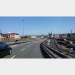
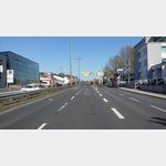
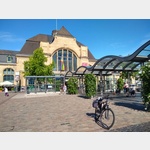
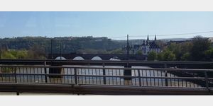
Pictures of the Poi and surroundings
Videos about the Poi and the surrounding area
.


.
Things to see in the area
Demirdag
Take away and eat there.[ click for more information ]
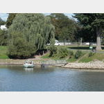
Campingplatz Gülser Moselbogen
 A beautiful place on the Moselle without fear of flooding
open 1 January - 31 December
[ click for more information ]
Balduinbrücke
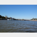 Baldwin Bridge Koblenz
[ click for more information ]
Resche Hennerich
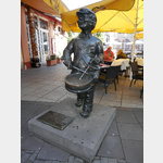 Sculpture: drum player by Fritz Berlin
[ click for more information ]
Marktfrau und Schutzmann
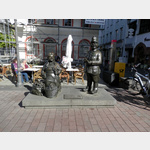 Sculpture by Fritz Berlin
[ click for more information ]
TouristInfo
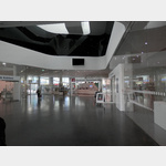 Tourist information in the Forum Confluentes
[ click for more information ]
Forum Mittelrhein Passage
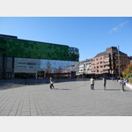 Diverse offer with numerous small and large shops.
[ click for more information ]
Entenbrunnen
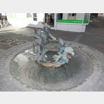 Artist: Edith Perres-Lethmate
[ click for more information ]
Romanticum
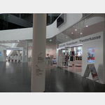 The focal point is the interactive experience exhibition in the Forum Confluentes, which enables a virtual journey through the Middle Rhine Valley.
 [ click for more information ]
Jesuitenplatz
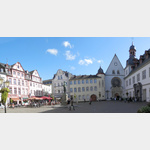 With the monument of Johannes Peter Müller and the City Church
[ click for more information ]
Historienbrunnen
 It was built in 1992 for the 2000th anniversary of the city of Koblenz.
 [ click for more information ]
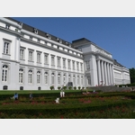
Kurfürstliches Schloss
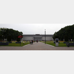 Electoral Palace Koblenz
[ click for more information ]
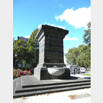
Peter-Altmeier-Denkmal
 He was Prime Minister of Rhineland-Palatinate from 1947 to 1969
[ click for more information ]
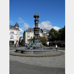
Napoleons-Brunnen
 Kastorbrunnen The fountain built in 1812 also commemorates the Napoleonic Wars.
 [ click for more information ]
Personenfähre Liesel
 The boat runs daily from 9:00 a.m.
 [ click for more information ]
Rheinseilbahn in Koblenz, auch BUGA-Seilbahn genannt
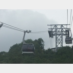 Rhine cable car specially built for the Federal Garden Show in Koblenz https://de.
 [ click for more information ]
 The Federal Horticultural Show 2011 will take place from April 15th to October 16th, 2011 in Koblenz.
 [ click for more information ]