GIS24.net
Geographic Information System
POI database from MEINWOMOmaps


Geographic Information System
POI database from MEINWOMOmaps
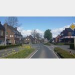
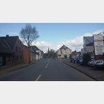
Appeldorn
/
ADDRESS
47546 KalkarSt.-Lambertus-Straße
WeiterUrl : https:/ / de.wikipedia.org/ wiki/ Appeldorn
UrlLoad : https:/ / yes
WikiText : Appeldorn ist ein Ortsteil der Stadt Kalkar am linken unteren Niederrhein. Es liegt im Südosten des Gebietes der Stadt Kalkar in der Rheinniederung. Mitte 2005 hatte es 1.671 Einwohner. Appeldorn ist Standort der Zuckerfabrik Pfeifer &, Langen. Am Naturschutzgebiet Boetzelaer Meer, einem ehemaligen Rheinarm, liegt Burg Boetzelaer, eine zum Hotel umgebaute ehemalige Wasserburg, die auch für kulturelle Veranstaltungen genutzt wird. Im nahegelegen Reichswald und im Umfeld des heutigen Ortes, tobte im Frühjahr 1945 die sogenannte Schlacht im Reichswald. In dieser Schlacht um den Niederrhein wurde der Ort schwer in Mitleidenschaft gezogen.
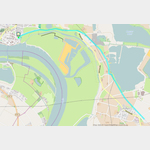
Click for interactive map
..
Pictures of the Poi and surroundings
Videos about the Poi and the surrounding area
.


.
Things to see in the area
Hochwald-Spargel
The family business specializes in asparagus, strawberries and new potatoes.[ click for more information ]
ParkenWomo
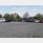 A free parking lot close to the Rhine promenade, but only stood there for 2 hours.
 [ click for more information ]
Realschule der Stadt Rees
Realschule of the city of Rees Rees[ click for more information ]
Supermarkt
real supermarket[ click for more information ]
Wächtertürmchen am Froschteich
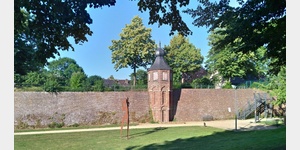 1480 wurde das Wächtertürmchen zur Verstärkung der Reeser Stadtbefestigung errichtet und 1992/93 nach historischem Vorbild wiederaufgebaut.
[ click for more information ]
Parkplatz Griether Straße
Simple parking lot for 3-5 mobile homes, which is also suitable for overnight stays.[ click for more information ]
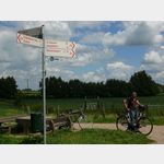
Faehre
Rhine ferry for pedestrians and cyclists.[ click for more information ]
Radtour vom Stellplatz in Rees nach Wesel entlang des Rheins und zurück
Bike tour from the parking space in Rees to Wesel along the Rhine and back.[ click for more information ]
Radtour nach Emmerich und zurück
Cycle tour to Emmerich along the Rhine (on the left) and back to Rees on the other side.[ click for more information ]
Stadtsparkasse Emmerich-Rees
Stadtsparkasse Emmerich-Rees Rees[ click for more information ]
Rewe
Rewe supermarket Rees[ click for more information ]
St.Mariä Himmelfahrt
St.[ click for more information ]
Mühlenturm
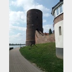 It was built in 1470 and had 3 functions.
 [ click for more information ]
Planetenweg Rees
 The planetary path illustrates our solar system with the nine planets.
 [ click for more information ]
Planetenweg Rees
The planet path illustrates our solar system with the nine planets. [ click for more information ]
Avia
Avia gas station Rees[ click for more information ]