GIS24.net
Geographic Information System
POI database from MEINWOMOmaps


Geographic Information System
POI database from MEINWOMOmaps
Reicholzried
/
ADDRESS
87463 DietmannsriedAlpenstraße
WeiterUrl : https:/ / de.wikipedia.org/ wiki/ Reicholzried
UrlLoad : https:/ / yes
WikiText : Reicholzried ist ein Ortsteil der Gemeinde Dietmannsried und liegt im Landkreis Oberallgäu. Er erhebt sich 720 m über dem Meeresspiegel, hat 1040 Einwohner und eine Fläche von 14765 Quadratkilometer. Der Ortsname mit der Endung ried ist ein typisch Allgäuer Ortsname. "Ried" bedeutet soviel wie Rodung. Die naheliegende Vermutung, Reicholzried bedeutet "eine Rodung reich an Holz" trifft wohl nicht zu. Vielmehr dürfte ein Mann namens Richolf die Siedlung in karolingischer Zeit gegründet haben. Im Laufe der mittelhochdeutschen Lautverschiebung entwickelte sich dann aus Richolfsried Reicholzried. Der nahe gelegene Weiler Sachsenried gilt als Rodung zwangsverpflanzter sächsischer Siedler. Das erste schriftliche Dokument für Reicholzried gibt es aus dem Jahr 1218. Damals waren Heinrich und Berthold von Richolfsried Zeugen in Ulm,als das Kloster Kempten von Kaiser Friedrich II. die Schirmvogtei erhielt. Aus der langen Ortsgeschichte sei eine Begebenheit besonders erwähnt,weil heute noch Axtspuren an der eisenbeschlagenen Sakristeitüre der Kirche daran erinnern: Am 22.Mai 1632 plünderten 300 schwedische Reiter das Dorf und brannten es mitsamt der Kirche nieder. Dabei kam auch der Pfarrer Ulrich Weinhart zu Tode. Reicholzried liegt 12 km nördlich von Kempten auf einer Endmoräne des Illergletschers. Im nördlichen Oberallgäu ist der Ort weithin sichtbar. Das alte Illertal liegt breit im Osten. Doch am Ende der Eiszeit nagte sich die Iller ein neues Flussbett durch die Moränen. Seitdem fließt der Fluss in vielen Windungen hin und her pendelnd zwischen Steilhang und Flachufer westlich an Reicholzried vorbei.
Click for interactive map
..
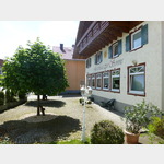
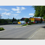
Pictures of the Poi and surroundings
.
Things to see in the area
Kreuzweg Reicholzried
Around 1900 the brick chapel and the Way of the Cross were laid out here.[ click for more information ]
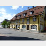
Landgasthaus zur fröhlichen Aussicht
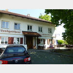 Popular place for excursions, especially for cyclists.
 [ click for more information ]
St.Michael
St Michael Krugzell[ click for more information ]
Parkplatz am Friedhof
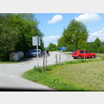 Parking on the outskirts below the church and cemetery.
 [ click for more information ]
Reifen Ohneberg
 Tires without mountain - if there is a problem with the tires.
 [ click for more information ]
Aral
Aral petrol station with kiosk.[ click for more information ]
Gasthof Hirsch
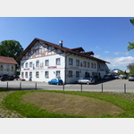 Popular excursion restaurant with ballroom.
 [ click for more information ]
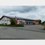
Rewe
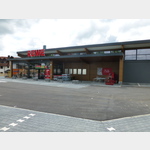 New food market with bakery and butcher
[ click for more information ]
Bahnhof
Dietmannsried train station[ click for more information ]
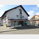
Apotheke
Andreas Hofer Pharmacy.[ click for more information ]
Oberallgäuer Rundwanderweg 1
The Oberallgäu circular hiking trail is an approximately 200 km long circular hiking trail through beautiful landscapes and places worth seeing.[ click for more information ]
Gasthof "zum Bären"
 Allgäu specialty made from Allgäu products.
[ click for more information ]
sonstiges
 Food market in the center of Altusried.
 [ click for more information ]
Parkplatz im Zentrum
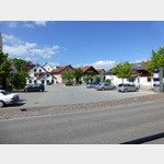 Parking in the center of Altusried.
 [ click for more information ]
Gasthof zur Sonne
 Allgäu and international delicacies.
[ click for more information ]
Netto
 Supermarket with bakery.
 [ click for more information ]