GIS24.net
Geographic Information System
POI database from MEINWOMOmaps


Geographic Information System
POI database from MEINWOMOmaps
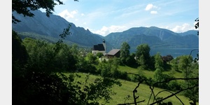
Steinbach am Attersee
/
ADDRESS
 4853 Steinbach am Attersee
Steinbach
WeiterUrl : https:/ / de.wikipedia.org/ wiki/ Steinbach am Attersee
UrlLoad : https:/ / yes
WikiText : Steinbach am Attersee ist flächenmäßig die größte Gemeinde im Bezirk Vöcklabruck im Hausruckviertel in Oberösterreich mit 845 Einwohnern. Der zuständige Gerichtsbezirk ist Vöcklabruck. Steinbach am Attersee liegt auf 509 ,m Höhe im Hausruckviertel. Die Ausdehnung beträgt von Nord nach Süd 8,6 ,km, von West nach Ost 10,9 ,km. Die Gesamtfläche beträgt 61,7 ,km. 59,8 ,% der Fläche sind bewaldet, 6 ,% der Fläche sind landwirtschaftlich genutzt. Ortsteile der Gemeinde sind: Berg, Blümigen, Dorf, Feld, Forstamt, Gmauret, Haslach, Hochlecken, Kaisigen, Kienklause, Kiental, Oberfeichten, Seefeld, Steinbach am Attersee, Unterfeichten, Unterroith, Weißenbach am Attersee.
Click for interactive map
..
Pictures of the Poi and surroundings
Videos about the Poi and the surrounding area
.
.
Things to see in the area
Pfarrkirche zum heiligen Andreas
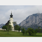 This small church, which is well worth seeing, is located on a hill above Steinbach.
[ click for more information ]
ADEG Bader
[ click for more information ]Picknickplatz neben einer Strasse
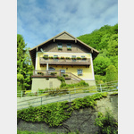
[ click for more information ]Bleibtreu-Villa
[ click for more information ]Gustav Mahler Gedenkstein
In 1996 a memorial stone was erected to mark the 100th anniversary of the completion of the 3rd symphony.[ click for more information ]
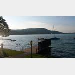
Schiffsanlegestelle
[ click for more information ]Camping Grabner
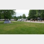 Camping in the family business on the Attersee
 open 1 April - 15 October
[ click for more information ]
Camping Seefeld des Hotel Föttinger
 Electricity and water connection on the entire site
is usable 1 April - 31 October
[ click for more information ]
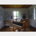
Gustav Mahler Komponierhäuschen
Memorial,[ click for more information ]