GIS24.net
Geographic Information System
POI database from MEINWOMOmaps


Geographic Information System
POI database from MEINWOMOmaps
Olsberg AG
/
ADDRESS

WeiterUrl : https:/ / de.wikipedia.org/ wiki/ Olsberg AG
UrlLoad : https:/ / yes
WikiText : Olsberg (schweizerdeutsch: [lb¡]) ist eine Einwohnergemeinde im Bezirk Rheinfelden des Schweizer Kantons Aargau. Sie liegt im Westen der Region Fricktal, rund drei Kilometer südlich der Grenze zu Deutschland und grenzt an den Kanton Basel-Landschaft. Das Dorf liegt im Tal des Violenbachs, in der bergangszone zwischen dem Tafeljura und dem Oberrheinischen Tiefebene und ist im doppelter Hinsicht zweigeteilt. Der Bach, der durch das Dorf fliesst, ist gleichzeitig die Kantonsgrenze. Der kleinere Dorfteil im Süden, auch Ländli genannt, gehört zur Gemeinde Arisdorf im Kanton Basel-Landschaft. Der nördliche aargauische Dorfteil liegt am Fusse des 469 Meter hohen Schönenbergs. Drei Kilometer südsüdöstlich des Dorfzentrums befindet sich eine Exklave. Diese ist unbewohnt und umfasst einen Teil des Osthangs des Eileten (626 ,m ,ü. ,M.) mit dem Bowald. Die Fläche der Gemeinde beträgt 468 Hektaren, davon sind 277 Hektaren bewaldet und 24 Hektaren überbaut. Der höchste Punkt befindet sich auf 571 Metern im Nordwesten der Bowald-Exklave, die tiefste Stelle liegt auf 316 Metern am Violenbach.
Click for interactive map
..
Pictures of the Poi and surroundings
.
Things to see in the area
Waldparkplatz
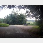 Free parking, very quiet area on the edge
usable March - November
[ click for more information ]
sonstiges
Rudi Russel gas station[ click for more information ]
Volg
Volg branch with post office[ click for more information ]
Plartkplatz am Rhein
Place very close to the Rhine, flat and quiet[ click for more information ]
sonstiges
Ruedi Rüssel gas station at Garage Egli AG[ click for more information ]
Stadtmuseum Rheinfelden
The city museum mainly shows objects from the city´s more recent history.[ click for more information ]
Fricktaler Museum
Interesting facts about the history and art of the region.[ click for more information ]
Tierarzt
Small animal practice Dr.[ click for more information ]
Narrenmuseum der Narrenzunft Rheinfelden
The fools´ guild presents their masks and costumes in the water tower, which was restored after 1980.[ click for more information ]
Schleifenbergturm
The 30 m high steel framework tower built in 1900 stands at a height of 603 m.[ click for more information ]
Turmrestaurant Schleifenberg
Opening times: Sundays and public holidays from 7:15 a.m.[ click for more information ]
Gitterlibad
Indoor/outdoor pools.[ click for more information ]
Der legendäre Westweg Ost 13
Dense fir forests, impressive mountain plateaus and water-rich valleys - The high-altitude hike on the legendary Westweg takes you through all the landscapes that make the Black Forest the hiking idyll that it is.[ click for more information ]
Museum.BL
The multi-genre museum is located in the former granary and arsenal of the town of Liestal, which was built around 1518[ click for more information ]