GIS24.net
Geographic Information System
POI database from MEINWOMOmaps


Geographic Information System
POI database from MEINWOMOmaps
Montborget
/
ADDRESS

WeiterUrl : https:/ / de.wikipedia.org/ wiki/ Montborget
UrlLoad : https:/ / yes
WikiText : www Montborget ist eine Ortschaft und früher selbständige politische Gemeinde im Distrikt Broye des Kantons Freiburg in der Schweiz. Am 1. Januar 1981 wurde Montborget nach Murist eingemeindet. Montborget liegt auf 650 ,m ,ü. ,M., 7.5 km südwestlich des Bezirkshauptortes Estavayer-le-Lac (Luftlinie). Das Dorf erstreckt sich in einer Mulde im Tal des Bainoz (linker Seitenbach der Petite Glne), im Molassehügelland zwischen dem Neuenburgersee und dem mittleren Broyetal, im nordwestlichen Freiburger Mittelland. Die ehemalige Gemeindefläche betrug rund 1.3 km. Das Gebiet reichte vom Bachlauf des Bainoz nordwärts über die Mulde von Montborget bis auf die Höhe La Frte (687 ,m ,ü. ,M.).
Click for interactive map
..
Pictures of the Poi and surroundings
.
Things to see in the area
Parkplätze am Tennisclub, nachts ruhig
[ click for more information ]Nur Platz für Ver-/Entsorgung
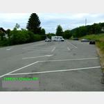 2 parking spaces diagonally vis-a-vis
 is usable January - December
[ click for more information ]
Autowaschanlage
[ click for more information ]Parkenprivat
[ click for more information ]Parkenprivat
[ click for more information ]Parkenpkw
[ click for more information ]Raiffeisen d´Yvonand
[ click for more information ]Tour Saint-Martin (Molondin)
The observation tower is at a height of 619 m.[ click for more information ]