GIS24.net
Geographic Information System
POI database from MEINWOMOmaps


Geographic Information System
POI database from MEINWOMOmaps
Goumois JU
/
ADDRESS

WeiterUrl : https:/ / de.wikipedia.org/ wiki/ Goumois JU
UrlLoad : https:/ / yes
WikiText : Goumois war bis zum 31. Dezember 2008 eine politische Gemeinde im Distrikt Franches-Montagnes des Kantons Jura in der Schweiz. Sie hat mit Wirkung auf den 1. Januar 2009 zusammen mit Les Pommerats und Saignelgier zur Gemeinde Saignelgier fusioniert. Goumois liegt auf 493 ,m ,ü. ,M., 3 km westlich des Bezirkshauptorts Saignelgier (Luftlinie). Das Grenzdorf liegt am rechten Ufer des Doubs in einem canyonartig in den Jura eingeschnittenen Tal.
Click for interactive map
..
Pictures of the Poi and surroundings
Videos about the Poi and the surrounding area
.
.
Things to see in the area
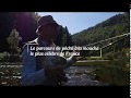
Rocher du Singe
[ click for more information ]Camping communal Goumois
The Camping communal Goumois campsite in Vautenaivre, Switzerland, offers a beautiful location on the Doubs River on the Swiss sideopen 1 April - 31 October
[ click for more information ]
Grotte du Bief Parou
[ click for more information ]Belvédère du Bief Parou
[ click for more information ]Camping Municipal La Forge
A small campsite on the river to the Swiss borderopen 1 April - 31 October
[ click for more information ]
Belvédère de la Corniche de Goumois
[ click for more information ]Belvédère des Fougères
[ click for more information ]Rochers des Sommêtres
[ click for more information ]Auberge moulin du Plain
[ click for more information ]Maison du Cur Eucharistique
[ click for more information ]Espace La Velle
ancienne église du Noirmont[ click for more information ]
La Traction II
With historic trains through the Jura between le Noirmont and Tavannes[ click for more information ]