GIS24.net
Geographic Information System
POI database from MEINWOMOmaps


Geographic Information System
POI database from MEINWOMOmaps
Augst
/
ADDRESS

WeiterUrl : https:/ / de.wikipedia.org/ wiki/ Augst
UrlLoad : https:/ / yes
WikiText : Augst (Baseldeutsch: Augscht [a¡t]) ist eine politische Gemeinde im Bezirk Liestal des Kantons Basel-Landschaft in der Schweiz. Die Gemeinde wurde früher Baselaugst genannt - zur Unterscheidung von dem zu Vorderösterreich gehörenden Kaiseraugst. Die Gemeinde Augst liegt auf 275 m ü.M. am nordöstlichen Ende des Kantons Basel-Landschaft, an der Mündung der Ergolz in den Rhein. Auf rotem Grund ein silberner Löwenkopf mit goldener Zunge und goldener Krone. Dies ist das Wappen der Edelknechte Pfirter von Liestal, welche im 14. Jahrhundert den Brückenzoll an der Ergolz in Augst einzogen.
Click for interactive map
..
Pictures of the Poi and surroundings
Videos about the Poi and the surrounding area
.


.
Things to see in the area
Camping and swimming pool on the Rhine
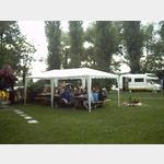 SUPER-small but fine place directly on the Rhine before the dam, ideal for swimming
usable 31 March - 17 September
[ click for more information ]
RV park Wyhlen
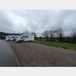 Visitors´ car park of the Wyhlen power plant and the circular walk around the nature reserve
usable 1 January - 31 December
[ click for more information ]
Römermuseum Augst
Augusta Raurica[ click for more information ]
Museum im Bürgerhaus
The permanent exhibition shows Prattler finds and objects from 300,000 years of history[ click for more information ]
B2 Boulders
Bouldering hall, courses[ click for more information ]
Volg
with postal agency[ click for more information ]
Ortsmuseum Frenkendorf
The permanent local history exhibition of the Frenkendorf local museum includes cultural assets from the village[ click for more information ]
Kantonalbank
Basellandschaftliche Kantonalbank[ click for more information ]
Die Salzkammer
In the The Salt Chamber museum, visitors experience the diverse areas in which salt plays an important role in human culture.[ click for more information ]
Eigenturm
The viewing tower has been on the 523 m high Hirzenleck since 2006.[ click for more information ]
sonstiges
Ruedi Rüssel gas station at Garage Galliker AG[ click for more information ]
Der legendäre Westweg Ost 13
Dense fir forests, impressive mountain plateaus and water-rich valleys - The high-altitude hike on the legendary Westweg takes you through all the landscapes that make the Black Forest the hiking idyll that it is.[ click for more information ]
Schleifenbergturm
The 30 m high steel framework tower built in 1900 stands at a height of 603 m.[ click for more information ]
Turmrestaurant Schleifenberg
Opening times: Sundays and public holidays from 7:15 a.m.[ click for more information ]