GIS24.net
Geographic Information System
POI database from MEINWOMOmaps


Geographic Information System
POI database from MEINWOMOmaps
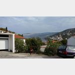
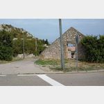
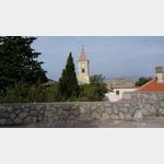
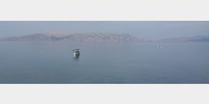
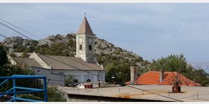
Sveti Juraj
/
ADDRESS

WeiterUrl : https:/ / de.wikipedia.org/ wiki/ Sveti Juraj
UrlLoad : https:/ / yes
WikiText : Sveti Juraj (auch Jurjevo, deutsch übersetzt St. Georg) ist ein Fischerdorf an der kroatischen Küste, 10 km südlich von Senj, mit 961 Einwohnern. Es liegt an der kroatischen Küstenstraße Jadranska magistrala am Fuße des Velebit-Gebirges. Der Gebirgspass Oltar (1002 m) führt von Sveti Juraj über das Velebit-Massiv. Der Ort lebt hauptsächlich vom Tourismus und Fischfang. Außerdem gibt es eine Holzfabrik. In der Bucht von Sveti Juraj liegt ein geschützter Ankerplatz für kleinere Schiffe. Dem Hafen vorgelagert ist eine Felseninsel.
Click for interactive map
..
Pictures of the Poi and surroundings
.
Things to see in the area
Selo
[ click for more information ]Ziel
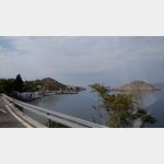
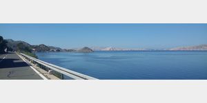
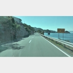 On the Croatian B8 between Crikvenica and Starigrad: Sveti Juraj
[ click for more information ]
Picknickplatz
[ click for more information ]Autocamp Raca
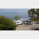 Autocamp, about 10 km south of Senj, directly by the sea, below the coastal road
usable 1 May - 30 September
[ click for more information ]
Picknickplatz
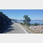
[ click for more information ]Adriatic Road
[ click for more information ][ click for more information ]