GIS24.net
Geographic Information System
POI database from MEINWOMOmaps


Geographic Information System
POI database from MEINWOMOmaps
Barfleur
/
ADDRESS
50760 BarfleurRue des Ãcoles
WeiterUrl : https:/ / de.wikipedia.org/ wiki/ Barfleur
UrlLoad : https:/ / yes
WikiText : Vorlage:Infobox Gemeinde in Frankreich/Wartung/Höhen nicht numerisch Barfleur ist eine sehr kleine Gemeinde im Norden Frankreichs im Dpartement Manche in der Region Basse-Normandie. Sie hat ca. 650 Einwohner. Barfleur gehört zu den schönsten Dörfern Frankreichs. Das Dorf liegt ca. 28 Kilometer westlich von Cherbourg-Octeville auf der Cotentin-Halbinsel am rmelkanal.
Click for interactive map
..
Pictures of the Poi and surroundings
.
Things to see in the area
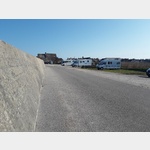
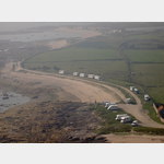
Barfleur Marina
[ click for more information ]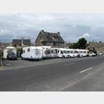 Parking at the port, also suitable for long campers.
 [ click for more information ]
ParkenAll
[ click for more information ]Wohnmobilstellpkatz Barfleur
 Has established itself in recent years and is apparently tolerated, although it is located in close proximity to the campsite
open January - December
[ click for more information ]
Parkenpkw
[ click for more information ]Parkenpkw
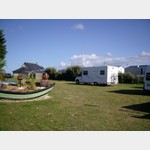
[ click for more information ]Camping Municipal La Blanche Nef
 The sanitary facilities have been renovated and are in top condition
usable 15 February - 15 November
[ click for more information ]
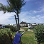
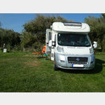
Camping Indiana
 Small, family-run campsite on the outskirts of Barfleur
is usable 21 June - 13 September
[ click for more information ]
ParkenAll
[ click for more information ]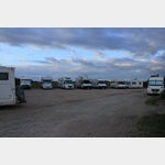 Possibility to spend the night in a parking lot by the sea.
 [ click for more information ]
Einkaufsparkplatz
[ click for more information ]Carrefour Contact
[ click for more information ]Camping La Ferme du Bord de Mer
 A small campsite right on the beach
open 27 March - 2 October
[ click for more information ]
Parkplatz, auch zum Übernachten
 To stay in the vicinity of the lighthouse
is open January - December
[ click for more information ]
|Bezeichnung||Leuchtfeuer|
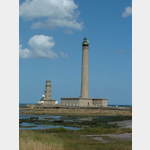
Phare de Gatteville[ click for more information ]