GIS24.net
Geographic Information System
POI database from MEINWOMOmaps


Geographic Information System
POI database from MEINWOMOmaps
Rustrel
/
ADDRESS
WeiterUrl : https:/ / de.wikipedia.org/ wiki/ Rustrel
UrlLoad : https:/ / yes
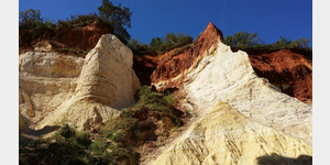
WikiText : Rustrel ist eine südfranzösische Gemeinde in der Region Provence-Alpes-Cte dAzur. Sie gehört zum Dpartement Vaucluse und zum Arrondissement Apt. Der Ort hat etwa 600 Einwohner und eine Fläche von 28 km. Das Dorf liegt am Fuße zweier Hügel, in der Nähe der Stadt Apt. Bekannt sind seine verschiedenfarbigen Ockerfelsen. An einigen Stellen wird noch Ocker abgebaut, um daraus Naturfarben für das Kunstgewerbe zu gewinnen. Die Einheimischen erzählen, dass über 20 verschiedene Farben gewonnen werden können.
Click for interactive map
..
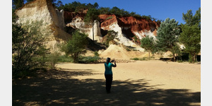
Pictures of the Poi and surroundings
.
Things to see in the area
Toilette
[ click for more information ]Picknickparkplatz Rustrel
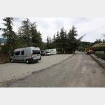 Two terraced parking spaces close to the center with an adjoining PicNic area
usable January - January
[ click for more information ]
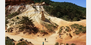
Tagesparkplatz A.C.R. des Mille Couleursö
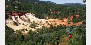
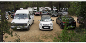 Parking lot Mille Couleurs (Le Colorado provençal) From the parking lot it goes directly into the Colorado de Rustrel, super landscape You can choose between three hiking trails, depending on your mood and mood for hiking.
 [ click for more information ]
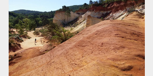
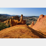
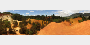
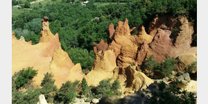
Le Colorado de Rustrel
[ click for more information ]Im Colorado de Rustrel
Le Colorado provencal de Rustrel is an area of ocher rock that dwarfs the ocher quarries of Roussillion.[ click for more information ]
Camping Le Colorado
The site is located close to the ocher rocks in wooded terrainis usable 31 March - 4 November
[ click for more information ]