GIS24.net
Geographic Information System
POI database from MEINWOMOmaps


Geographic Information System
POI database from MEINWOMOmaps
Rorodt
/
ADDRESS
77716 RorodtK 116
WeiterUrl : https:/ / de.wikipedia.org/ wiki/ Rorodt
UrlLoad : https:/ / yes
WikiText : 61 (31. ,Dez. ,2008)[1] Rorodt im Hunsrück ist eine Ortsgemeinde im Landkreis Bernkastel-Wittlich in Rheinland-Pfalz. Sie gehört der Verbandsgemeinde Thalfang am Erbeskopf an. In einer Urkunde von 1136 wird der Ort als Roveroth erstmals urkundlich erwähnt. Rorodt gehörte bis zur Säkularisation zum Erzstift Trier und war Teil der Mark Thalfang. Nach der französischen Herrschaft kam der Ort 1814 zum Königreich Preußen. Seit 1947 ist der Ort Teil des neu gegründeten Landes Rheinland-Pfalz.
Click for interactive map
..
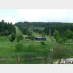
Pictures of the Poi and surroundings
.
Things to see in the area
Kirche
Trinity Church Deuselbach[ click for more information ]
Wohnmobil-Parkplatz Bauernhofcafe Hunolsteiner Hof
The cafe is quietly situated between fields, a bit off Hunolsteinis open 1 January - 31 December
[ click for more information ]
Outdoorcamping Massingsmühle
A beautifully situated campsite surrounded by forestopen 1 May - 30 September
[ click for more information ]
Burg Hunolstein
[ click for more information ]Burg Hunolstein
[ click for more information ]Burg Hunolstein
[ click for more information ]Hunsrücker Holzmuseum
[ click for more information ]Wohnmobilstellplatz Hunsrückhaus Deuselbach
 The Husnrückhaus team informed the portal on May 21, 2021 that there were no longer any mobile home parking spaces parking spaces with electricity directly in front of the Hunsrückhaus.
 [ click for more information ]
Ladestation
[ click for more information ]Hunsrückhaus
 Das Hunsrückhaus ....
 [ click for more information ]
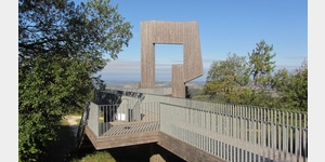
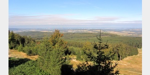
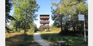
Aussichtsturm Erbeskopf
In 1971, the 11 m high tower stood on the 816 m high Erbeskopf. [ click for more information ]
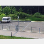
Wanderparkplatz Erbeskopf
Ideal starting point for activities in the region[ click for more information ]