GIS24.net
Geographic Information System
POI database from MEINWOMOmaps


Geographic Information System
POI database from MEINWOMOmaps
Körborn
/
ADDRESS
66869 KörbornBrunnenweg
WeiterUrl : https:/ / de.wikipedia.org/ wiki/ Körborn
UrlLoad : https:/ / yes
WikiText : 353 (31. ,Dez. ,2008)[1] Körborn ist eine Ortsgemeinde im Landkreis Kusel in Rheinland-Pfalz (Deutschland). Sie gehört zur Verbandsgemeinde Kusel. Körborn wurde im Jahr 1270 als Cuberin erstmals urkundlich erwähnt. Zusammen mit Ruthweiler und Thallichtenberg gehörte es lange zur Burg Lichtenberg.
Click for interactive map
..
Pictures of the Poi and surroundings
Videos about the Poi and the surrounding area
.

.
Things to see in the area
Wohnmobilstellplatz Burg Lichtenberg
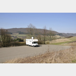 Parking space at the end of a bus turning space at one of the largest castles in Germany
open January - December
[ click for more information ]
Bergfried Burg Lichtenberg (Pfalz)
The 13th-century keep was raised by 2 floors in 1983 and expanded into a lookout tower.[ click for more information ]
Burg Lichtenberg
The castle was first mentioned in a document in 1214 but has fallen into serious ruin.[ click for more information ]
Klinik
2230834_Beschreibung[ click for more information ]
Freibad
Bathing and leisure park in Kusel[ click for more information ]
Polizei
Police Inspectorate Kusel[ click for more information ]
jet
2230837_Beschreibung[ click for more information ]
Kirche
Protestant city church in Kusel[ click for more information ]
Kirche
St.[ click for more information ]
Burger King
Restaurant Burger King Kusel[ click for more information ]
McDonald
Restaurant McDonald Baumholder[ click for more information ]
TouristInfo
Tourist Information Baumholder[ click for more information ]
Netto
Net Market Baumholder[ click for more information ]
Revolution Laundry
Launderette with self-service and 24h service[ click for more information ]
Esso
Esso gas station Baumholder[ click for more information ]