GIS24.net
Geographic Information System
POI database from MEINWOMOmaps


Geographic Information System
POI database from MEINWOMOmaps
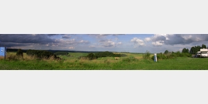
Demerath
/
ADDRESS
54552 DemerathK 22
WeiterUrl : https:/ / de.wikipedia.org/ wiki/ Demerath
UrlLoad : https:/ / yes
WikiText : 322 (31. ,Dez. ,2008)[1] Demerath ist eine Ortsgemeinde im Landkreis Vulkaneifel in Rheinland-Pfalz. Sie gehört der Verbandsgemeinde Daun an. In unmittelbarer Umgebung von Demerath befinden sich einige Maare, zum Beispiel das Pulvermaar und das Holzmaar in Gillenfeld, das Schalkenmehrener Maar und das Ulmener Maar. Die Entfernung nach Cochem an der Mosel und zum Nürburgring beträgt jeweils 25 km.
Click for interactive map
..
Pictures of the Poi and surroundings
Videos about the Poi and the surrounding area
.
.
Things to see in the area
Parkplatz Autobahn
Parking lot Steininger height A 48 Steiningen[ click for more information ]
Parkplatz Autobahn
Parking lot Bierscheid A 48 Steiningen[ click for more information ]
Vulcano Infoplattform
In 2003, the 28 m high tower was built from Douglas fir trunks.[ click for more information ]
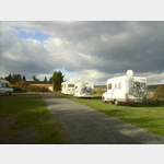
Parkenwomo
[ click for more information ]Spaziergang vom SP nach Gillenfeld
Walk from the parking space to Gillenfeld for strolling and shopping.[ click for more information ]
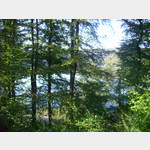
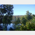
Rundwanderung zum Holzmaar
Circular hike to the Holzmaar from the parking space via Gillenfeld.[ click for more information ]
Wanderung um das Pulvermaar bei Gillenfeld
Hike around the Pulvermaar from the pitch.[ click for more information ]
Apotheke
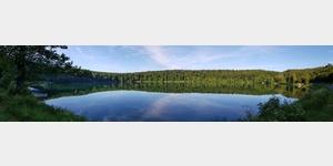
[ click for more information ]Pulvermaar
[ click for more information ]Burgruine Ulmen
Antoniusstrasse[ click for more information ]