GIS24.net
Geographic Information System
POI database from MEINWOMOmaps


Geographic Information System
POI database from MEINWOMOmaps
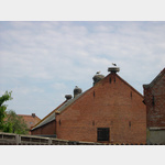
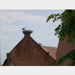
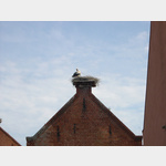
Rühstädt
/
ADDRESS
RühstädtMäsche
WeiterUrl : https:/ / de.wikipedia.org/ wiki/ Rühstädt
UrlLoad : https:/ / yes
WikiText : 558 (31. ,Dez. ,2008)[1] Rühstädt ist eine Gemeinde im Landkreis Prignitz im nordwestlichen Brandenburg. Die Gemeinde Rühstädt liegt im nordwestlichen Brandenburg in der Prignitz, ca. 12 ,km südöstlich der Stadt Wittenberge, nahe der Havelmündung in die Elbe. Das Dorf Rühstädt selbst hat ca. 240 Einwohner. Die Gemeinde ist Teil des Amtes Bad Wilsnack/Weisen.
Click for interactive map
..
Pictures of the Poi and surroundings
Videos about the Poi and the surrounding area
.
.
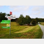
Things to see in the area
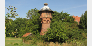
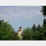
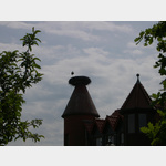
Wasserturm
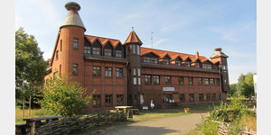
[ click for more information ]Schloßhotel Rühstädt
[ click for more information ]Schloßhotel Rühstädt
[ click for more information ]Schloßhotel Rühstädt
[ click for more information ]Landgasthof Storchenkrug
[ click for more information ]Wohnmobilstellplatz Rühstädt
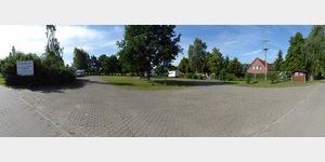 Parking at the visitor center NABU
usable January - January
[ click for more information ]
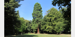
Schlosspark Rühstädt
[ click for more information ]Walter-Fritze-Fotopunkt
[ click for more information ]UNESCO Biosphärenreservat
[ click for more information ]Bruecke
Bridge at the mouth of the Havel in the Elbe.[ click for more information ]
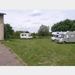
Parkplatz
 Small shaded parking lot in front of the dike, 50 m next to the Gnevsdorf receiving water (weir system) at the mouth of the Havel
usable January - December
[ click for more information ]
Restaurant Dörpkrog an Diek
 The parking spaces are behind the restaurant.
 [ click for more information ]