GIS24.net
Geographic Information System
POI database from MEINWOMOmaps


Geographic Information System
POI database from MEINWOMOmaps
Sankt Peter am Hart
/
ADDRESS
 4963 Gemeinde Sankt Peter am Hart
Hartforststraße
WeiterUrl : https:/ / de.wikipedia.org/ wiki/ Sankt Peter am Hart
UrlLoad : https:/ / yes
WikiText : Sankt Peter am Hart ist eine Gemeinde in Oberösterreich im Bezirk Braunau am Inn im Innviertel mit 2.403 Einwohnern (2001). Der zuständige Gerichtsbezirk ist Braunau am Inn. Sankt Peter am Hart liegt auf 372 m Höhe im Innviertel. Die Ausdehnung beträgt von Nord nach Süd 6 km, von West nach Ost 6,4 km. Die Gesamtfläche beträgt 22,9 km. 14,8 ,% der Fläche sind bewaldet, 62,9% der Fläche sind landwirtschaftlich genutzt. Ortsteile der Gemeinde sind: Aching, Aham, Am Mühlberg, Aselkam, Bergham, Bogenhofen, Dietfurt, Guggenberg, Hagenau, Hart, Heitzenberg, Hundslau, Jahrsdorf, Luisenhöhe, Meinharting, Moos, Mooswiesen, Nöfing, Ofen, Reikersdorf, Sankt Peter am Hart, Schickenedt, Spraid, Wimm.
Click for interactive map
..
Pictures of the Poi and surroundings
Videos about the Poi and the surrounding area
.

.
Things to see in the area
Oberstufenrealgymnasium Bogenhofen
[ click for more information ]Schloss Hagenau
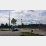
[ click for more information ]Parkplatz am Vogelbeobachtungsturm und einem kleinen See
[ click for more information ]Picknick
[ click for more information ]Waschbär-Center
[ click for more information ]Spar
[ click for more information ]Renner Manfred BP Gasvertrieb
T: 43 (0) 772263502[ click for more information ]
Hofer
Hofer, Braunau am Inn Bauhofstrasse , Braunau am Inn-Ranshofen, Austria[ click for more information ]
Braunau Schwimmbad
 Large day parking lot behind the indoor and outdoor pools.
 [ click for more information ]
Bahnhof
Train station Braunau / Inn[ click for more information ]