GIS24.net
Geographic Information System
POI database from MEINWOMOmaps


Geographic Information System
POI database from MEINWOMOmaps
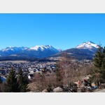
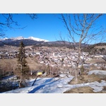
Ramingstein
/
ADDRESS
 5591 Gemeinde Ramingstein
Turracher Straße
WeiterUrl : https:/ / de.wikipedia.org/ wiki/ Ramingstein
UrlLoad : https:/ / yes
WikiText : Ramingstein ist eine der 15 Gemeinden im Lungau, Salzburg in sterreich. Ramingstein liegt im äußersten Südosten des Landes Salzburg im Bezirk Tamsweg am Dreiländereck Salzburg, Steiermark und Kärnten. Ramingstein ist die einzige Gemeinde im Lungau, die unterhalb von 1000 ,m Seehöhe liegt. Die Gemeinde liegt direkt an der Mur, oberhalb des Ortes erhebt sich die Burg Finstergrün, das Wahrzeichen von Ramingstein. Südlich der Mur erstreckt sich die Gemeinde ins Lungauer Nockgebiet und nördlich der Mur ins Gebiet der Murberge. Sie ist die flächenmäßig viertgrößte Gemeinde des Lungaues. Die vier Dörfer Madling, Ramingstein, Kendlbruck und Karneralm bilden die Siedlungszentren.
Click for interactive map
..
Pictures of the Poi and surroundings
Videos about the Poi and the surrounding area
.

.
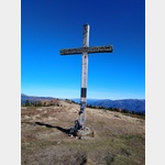
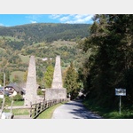
Things to see in the area
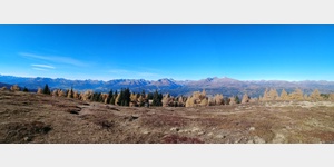
Parkenwander
[ click for more information ]Burg Finstergrün
[ click for more information ]Burg Finstergrün
[ click for more information ]Ramingstein Thomatal
[ click for more information ]Silberbergwerk Ramingstein
 Very interesting historic show mine.
 [ click for more information ]
Parkplatz in Madling
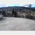 Small parking lot directly on the main road and on the banks of the Mur
is usable January - December
[ click for more information ]
ParkenWander
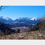
[ click for more information ]Wanderung auf das Lasaberger Aibl
From the hiking car park, take a well-marked path, no.[ click for more information ]
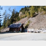
Hochofenanlage Kendlbruck
 The Kendlbruck smelter is one of the most valuable monuments of Alpine ironwork.
 [ click for more information ]
Pircheck
[ click for more information ]Wallfahrtskirche zu Unserer Lieben Frau in Hollenstein
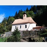 The origins of the church date back to the early 18th century.
 [ click for more information ]