GIS24.net
Geographic Information System
POI database from MEINWOMOmaps


Geographic Information System
POI database from MEINWOMOmaps
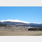
Mauterndorf
/
ADDRESS
 5570 Gemeinde Mauterndorf
Langwiesenweg
WeiterUrl : https:/ / de.wikipedia.org/ wiki/ Mauterndorf
UrlLoad : https:/ / yes
WikiText : Mauterndorf ist eine Marktgemeinde im Lungau und mit einer Einwohnerzahl von 1.806 die viertgrößte Gemeinde des Gebietes. Das Gemeindegebiet setzt sich aus den Katastralgemeinden Faningberg, Mauterndorf, Neuseß und Steindorf zusammen. Die Einwohner sind überwiegend (88,2 ,%) römisch-katholisch. Zweitgrößte Religionsgemeinschaft ist der Islam, dem 4,2 ,% der Einwohner angehören. Evangelisch sind 1,2 ,%, ohne religiöses Bekenntnis sind 5,6 ,%.
Click for interactive map
..
Pictures of the Poi and surroundings
Videos about the Poi and the surrounding area
.


.
Things to see in the area
Friedhof St. Gertrauden
[ click for more information ]Friedhof St. Gertrauden
[ click for more information ]Friedhof St. Gertrauden
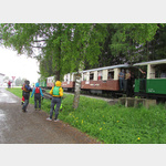
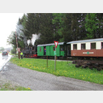
[ click for more information ]Taurachbahn
With the historical museum railway between Mauterndorf and St. [ click for more information ]
Mountainbike - Trogalmrunde
The round begins and ends in Mauterndorf.[ click for more information ]
Burg Mauterndorf
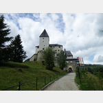 The tower and the palace are the oldest parts of the castle, construction of which began around 1250.
 [ click for more information ]
Großparkplatz bei den Fanningbergliften
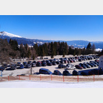 Large car park at the valley station of the Fanningberg lifts, Samsonbahn.
 [ click for more information ]
Billa Parkplatz
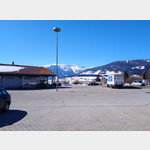 Parking at the Billa supermarket
[ click for more information ]
Murschleife
 Parking areas along the access road to the newly built recreation area in St.
 [ click for more information ]
Parkplatz Speiereck Sonnenbahn
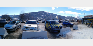 Large car park at the valley station of the Speiereck-Großeck ski area, ski area to Mauterndorf.
 [ click for more information ]