GIS24.net
Geographic Information System
POI database from MEINWOMOmaps


Geographic Information System
POI database from MEINWOMOmaps
Inzersdorf-Getzersdorf
/
ADDRESS
 3131 Gemeinde Inzersdorf-Getzersdorf
L5017
WeiterUrl : https:/ / de.wikipedia.org/ wiki/ Inzersdorf-Getzersdorf
UrlLoad : https:/ / yes
WikiText : Inzersdorf-Getzersdorf ist eine Gemeinde mit 1.424 Einwohnern im Bezirk Sankt Pölten-Land in Niederösterreich. Inzersdorf-Getzersdorf liegt im Mostviertel in Niederösterreich. Die Fläche der Gemeinde umfasst 13,72 Quadratkilometer. 8,45 Prozent der Fläche sind bewaldet. Katastralgemeinden sind Anzenberg, Getzersdorf, Inzersdorf ob der Traisen, Walpersdorf und Wetzmannsthal.
Click for interactive map
..
Pictures of the Poi and surroundings
.
Things to see in the area
Wohnmobilstellplatz Wetzmannsthaler Hof
Pitch next to a holiday pension and a wineryopen January - December
[ click for more information ]
Schloss Walpersdorf
[ click for more information ]Forerberg
[ click for more information ]Spar
[ click for more information ]Elektro-Ladstation
[ click for more information ]Stift Herzogenburg
[ click for more information ]Stift Herzogenburg
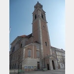 The art treasures of the Herzogenburg Abbey, which celebrates its 900th anniversary in 2012, can only be viewed as part of a guided tour.
 [ click for more information ]
Schloss Meidling
[ click for more information ]Spar
[ click for more information ]Asfinag Raststätte
free drinking water fountain at the bus parking lot, fill watering can or water bottles possible[ click for more information ]
Asfinag Raststätte
Snack available during the day, free drinking water at the bus parking lot[ click for more information ]