GIS24.net
Geographic Information System
POI database from MEINWOMOmaps


Geographic Information System
POI database from MEINWOMOmaps
Geras
/
ADDRESS
 2093 Gemeinde Geras
Hauptstraße
WeiterUrl : https:/ / de.wikipedia.org/ wiki/ Geras
UrlLoad : https:/ / yes
WikiText : Geras ist eine Stadtgemeinde mit 1.393 Einwohnern im Bezirk Horn in Niederösterreich. Geras liegt im nördlichen Waldviertel in Niederösterreich nördlich von Horn, das 22 Straßenkilometer entfernt ist. Die Fläche der Stadtgemeinde umfasst 67,66 Quadratkilometer. 35,21 Prozent der Fläche sind bewaldet. Katastralgemeinden sind Dallein, Fugnitz, Geras, Goggitsch, Hötzelsdorf, Harth, Kottaun, Pfaffenreith, Purgstall, Schirmannsreith, Sieghartsreith, Trautmannsdorf.
Click for interactive map
..
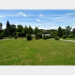
Pictures of the Poi and surroundings
.
Things to see in the area
Friedhof
[ click for more information ]Friedhof
[ click for more information ]Goggitschberg
[ click for more information ][ click for more information ]
Camping Geras Edlersee
 A campsite on a lake
is open 1 April - 31 October
[ click for more information ]