GIS24.net
Geographic Information System
POI database from MEINWOMOmaps


Geographic Information System
POI database from MEINWOMOmaps
Zihlschlacht-Sitterdorf
/
ADDRESS

WeiterUrl : https:/ / de.wikipedia.org/ wiki/ Zihlschlacht-Sitterdorf
UrlLoad : https:/ / yes
WikiText : Zihlschlacht-Sitterdorf ist eine politische Gemeinde im Bezirk Bischofszell des Kantons Thurgau in der Schweiz. Die Gemeinde entstand 1997 aus der bisherigen Munizipalgemeinde, zu der die Ortsgemeinden Zihlschlacht, Sitterdorf und Schocherswil gehörten. Schocherswil hat sich Amriswil angeschlossen. Rund 1200 Jahre alt sind sowohl der Gemeindeteil Zihlschlacht wie auch Sitterdorf. Obwohl es der Name vermuten lässt, war Zihlschlacht nie ein Schlachtort. Man vermutet, der Name stamme von den Alemannen, die den Wald in der Gegend schlugen. Der Namen Sitterdorf wurde erstmals 787 n.Chr. als Sidruna erwähnt. Namensgebend war der Fluss Sitter, der durch das Dorf fliesst und teilweise auch die Gemeindegrenzen bildet.
Click for interactive map
..
Pictures of the Poi and surroundings
Videos about the Poi and the surrounding area
.
.
Things to see in the area
Sitterdorf Flugplatz
 Private airport combined with adventure park.
 [ click for more information ]
Erlebnis Flugplatz Sitterdorf
Amusement park, animal park, Minidrom (race track for model cars)[ click for more information ]
Volg
with postal agency[ click for more information ]
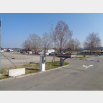
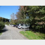
Parkplatz Klinikum
 public car park at the clinic.
 [ click for more information ]
Camping Leutswil
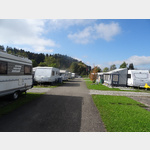 A small campsite in a very quiet location on the Sitter
open 1 April - 31 October
[ click for more information ]
Parkplatz
 Small car park on the Sitter river opposite Lütschwil.
 [ click for more information ]
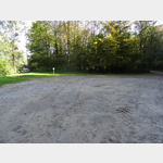
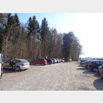
Wohnmobil-Waldparkplatz Hudelmoos, Zihlschlacht
 Quiet parking at the edge of the nature reserve Hudelmoos, a high moor, where former peat was mined
open 1 January - 31 December
[ click for more information ]
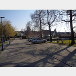
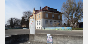
Sitterdorf Dorf
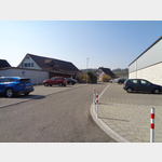 Village car park by the school building and sports facilities
[ click for more information ]
Gewerbeturm Amriswil
The 19 m high wooden tower, built in 2012, stands at a height of 497 m.[ click for more information ]
Horber Weiher
Der Horber Weiher ist der nördlichste der fünf Hauptwiler Weiher.[ click for more information ]
Rütiweier
Der Rüütiweiher (auf der Karte als Rütiweier bezeichnet) ist ein Kleinsee in der Thurgauer Gemeinde Hauptwil-Gottshaus.[ click for more information ]
Bahnhof Bischofszell
 Parking at the train station
[ click for more information ]
Parkplatz Hauptwilerweiher
 Parking right by the lake
[ click for more information ]
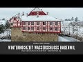
Schloss Hagenwil
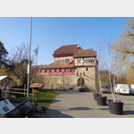 Parking at Hagenwil Castle
[ click for more information ]
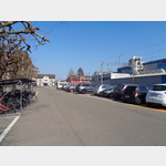
Parkplatz Stadthaus Süd
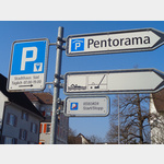 Parking directly at the Pentorama
[ click for more information ]
Parkplatz Waldhof
 Parking lot as a starting point to the rest.
 [ click for more information ]
Parkplatz Bahnübergang
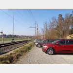 Parking on the main road and railway line.
 [ click for more information ]
Parkplatz Sonnenberg
 Parking right next to the Sonnenberg school.
 [ click for more information ]