GIS24.net
Geographic Information System
POI database from MEINWOMOmaps


Geographic Information System
POI database from MEINWOMOmaps
Ferrette
/
ADDRESS
68480 FerretteRue du Château
WeiterUrl : https:/ / de.wikipedia.org/ wiki/ Ferrette
UrlLoad : https:/ / yes
WikiText : Ferrette (deutsch Pfirt) ist der Hauptort des gleichnamigen französischen Kantons im elsässischen Dpartement Haut-Rhin. Ferrette ist Mitglied des Gemeindeverbandes Communaut de communes du Jura Alsacien. Mit mehr als 1000 Einwohnern ist Pfirt zugleich einwohnermässig die größte Gemeinde des Kantons, aber nicht flächenmässig. Im Norden und Westen liegt die Gemeinde Vieux-Ferrette und im Süden und im Osten Bouxwiller. In Ferrette beginnt der Sentier Interregio, ein interkommunaler Wanderweg, der anschließend das südwestlich liegende Sondersdorf passiert. Außerdem grenzt der Kantonshauptort im Süden an Ligsdorf und im Südwesten an Bendorf. Südlich der Ortsmitte liegt der Weiler Bergmatten, erreichbar auf der Dpartementsstraße 432 nach einer engen Kurve.
Click for interactive map
..
Pictures of the Poi and surroundings
Videos about the Poi and the surrounding area
.
.
Things to see in the area
Chateau de Ferrette
[ click for more information ]Chateau de Ferrette
As early as 1100, the castle owned by the Counts of Pfirt was mentioned.[ click for more information ]
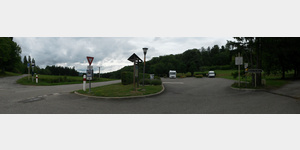
ParkenAll
[ click for more information ]Parkenwander
[ click for more information ]Apotheke
[ click for more information ]Parkenpkw
[ click for more information ]Echter Stellplatz
 - Supply and disposal with Euro relay station
 usable January - December
[ click for more information ]
Parkenwander
[ click for more information ]ParkenAll
[ click for more information ]Rossbergturm
The observation tower is located on the 675 m high Rossberg.[ click for more information ]
Käserei Antony
Maître Antony´s cheese dairy is famous for its French soft cheeses.[ click for more information ]