GIS24.net
Geographic Information System
POI database from MEINWOMOmaps


Geographic Information System
POI database from MEINWOMOmaps
Malborn
/
ADDRESS
54426 MalbornHauptstraße
WeiterUrl : https:/ / de.wikipedia.org/ wiki/ Malborn
UrlLoad : https:/ / yes
WikiText : 1.340 (31. ,Dez. ,2008)[1] Malborn mit dem Ortsteil Thiergarten im Hunsrück ist eine Ortsgemeinde im Landkreis Bernkastel-Wittlich in Rheinland-Pfalz. Die Gemeinde gehört der Verbandsgemeinde Thalfang am Erbeskopf an. Die Gemeindefläche beträgt 26,3 km, davon sind 18,4 km Wald. Malborn liegt am Fuße des Steinkopfes (683 m), dort befindet sich ein Aussichtsturm.
Click for interactive map
..
Pictures of the Poi and surroundings
Videos about the Poi and the surrounding area
.
.
Things to see in the area
Burg Dhronecken
[ click for more information ]Burg Dhronecken
[ click for more information ]ParkenAll
[ click for more information ]Parkenwander
[ click for more information ]Rastplatz
[ click for more information ]Gesundheitszentrum
[ click for more information ]Wasgau
Food market incl.[ click for more information ]
Wasgau
Food market with a bakery, also open on Sundays.[ click for more information ]
Flugausstellung bei Hermeskeil
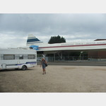 There is a cafe in the Concorde.
 [ click for more information ]
Prims
After 91 km she tires at Dillingen in the Saar.[ click for more information ]