GIS24.net
Geographic Information System
POI database from MEINWOMOmaps


Geographic Information System
POI database from MEINWOMOmaps
Niederurnen
/
ADDRESS

WeiterUrl : https:/ / de.wikipedia.org/ wiki/ Niederurnen
UrlLoad : https:/ / yes
WikiText : Niederurnen ist eine politische Gemeinde des Kantons Glarus in der Schweiz. Zu der Gemeinde gehört der südlich der Linth liegende Teil der Ortschaft Ziegelbrücke. Das Gemeindewappen ist zusammengesetzt aus dem Familienwappen der Edeln von Uranen und dem von Oberwindeck. Es basiert auf den Angaben des Wappenbuches von gidius Tschudi aus dem Jahr 1532. Die Gemeinde Niederurnen liegt im Glarner Unterland am Chli Linthli, dem linksseitigen Linthkanal. Zum Gemeindegebiet gehört das Niederurner Bergtal Niederurnertäli, die einzigen Alpweiden der Gemeinde. Mit 1879 ,m ,ü.M. ist der Köpfenberg der höchste Punkt der Gemeinde. Von der Gemeindefläche sind 10.6% besiedelt, 37.2% dienen der Landwirtschaft, 45.9% sind bewaldet und 6.4% sind unproduktiv.
Click for interactive map
..
Pictures of the Poi and surroundings
Videos about the Poi and the surrounding area
.
.
Things to see in the area
Wohnmobilstellplatz SGU Linth-Arena
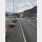 The space is paid for in the bistro, see also site map 1
is open January - December
[ click for more information ]
Lintharena
Adventure park with: climbing, bouldering, indoor swimming pool, indoor sports[ click for more information ]
Ortsmuseum Schänis
The focal points of the local museum, which was completely redesigned in 2017, are: Schänner history[ click for more information ]
BP
At the construction center ´Jumbo´[ click for more information ]
Einkaufzentrum direkt an der A3
In case you remember on the way what wasn´t packed.[ click for more information ]
Haslensee
Der kleine See liegt an einer Bergstrasse, die zum viel grösseren Obersee führt, auf einer Höhe von 729 Metern[ click for more information ]
Läderach: Schoggi Erlebnis ³ Outlet
Läderach: Presents the production of fine chocolate here.[ click for more information ]
Planetenweg Mollis
The models and the distances between them are on a scale of 1:2.[ click for more information ]
Ortsmuseum Mollis
The local museum has an extensive collection of writings, photos, tools and organizes temporary exhibitions on various topics from history, personalities and customs[ click for more information ]
Museum & Galerie Weesen
The permanent exhibition about Weesen in Roman times and about the medieval town, which was destroyed in 1388, is housed on the ground floor and first floor.[ click for more information ]
Torfstichsee
Er liegt im Gebiet Niderriet zwischen den Dörfern Bilten und Reichenburg auf einer Höhe von 411 Metern über Meer.[ click for more information ]