GIS24.net
Geographic Information System
POI database from MEINWOMOmaps


Geographic Information System
POI database from MEINWOMOmaps
Allinge-Gudhjem
/
ADDRESS

WeiterUrl : https:/ / de.wikipedia.org/ wiki/ Allinge-Gudhjem
UrlLoad : https:/ / yes
WikiText : Allinge-Gudhjem Kommune war bis Dezember 2002 eine dänische Kommune im damaligen Bornholms Amt auf der Insel Bornholm. Am 1. Januar 2003 wurde sie mit den Gemeinden Rnne, kirkeby, Hasle und Neks zur Bornholms Regionskommune zusammengeschlossen, welche von 2003 bis 2006 amtsfrei war, bevor sie 2007 in die Region Hovedstaden eingegliedert wurde. Allinge-Gudhjem Kommune entstand im Zuge der Verwaltungsreform von 1970 und umfasste folgende Sogn: kirkeby ,| Allinge-Gudhjem ,| Hasle ,| Neks ,| Rnne
Click for interactive map
..
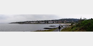
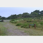
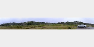
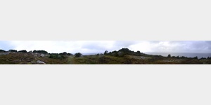
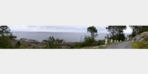
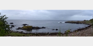
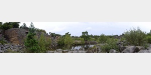
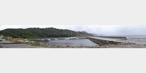
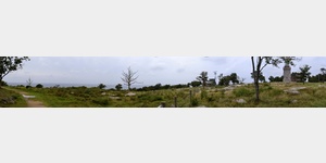
Pictures of the Poi and surroundings
.
Things to see in the area
Wohnmobilserviceplatz Circle K Allinge
Mobile home service station at a gas stationusable 1 January - 31 December
[ click for more information ]
sonstiges
2229650_Beschreibung[ click for more information ]
Allinge Kirke
The church in Allinge was built around 1500 as a chapel and expanded in 1894 to become a church.[ click for more information ]
Allinge Touristinformation
2229583_Beschreibung[ click for more information ]
Netto
Supermarket Netto with good parking facilities[ click for more information ]
sonstiges
2229649_Beschreibung[ click for more information ]
Camping Sandkås
Quick stop for campers (20is usable 13 April - 19 October
[ click for more information ]
Hammerode Fyr
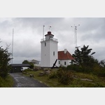 A new lighthouse was built at the northern tip of Bornholm, which took over the function of the lighthouse on Hammeren.
 [ click for more information ]
Hammersee
Der Hammersee ist der grösste See auf Bornholm und liegt 8 m über dem Niveau der Ostsee.[ click for more information ]
Opalsee
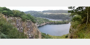 Der Opalsee ist entstanden, nachdem die Abbrucharbeiten an dem ehemaligen Steinbruch eingestellt wurden und sich die tiefen Löcher mit Wasser füllten.
[ click for more information ]
Besucher- Informationszentrum Burgruine Hammerhus
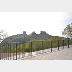 This visitor center is simply worth seeing.
 [ click for more information ]
Seilbahn
2229372_Beschreibung[ click for more information ]
Solomons Kapel
 In the Middle Ages, people made pilgrimages to the spot where Salomon´s chapel was built because Salomon´s spring was said to have a special effect.
 [ click for more information ]
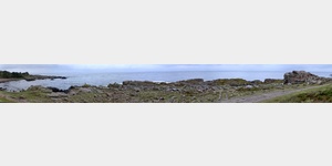
Hammeren Fyr
 The old lighthouse Hammeren Fyr is situated on the largest circular cliff in northern Bornholm at a height of 82 m above sea level.
 [ click for more information ]
Kristall See
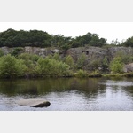 A narrow unpaved path leads from the old lighthouse to the old quarry on the Hammeren, where granite used to be mined.
 [ click for more information ]
Kongestolen
A walk north from Hammerhafen takes you to the most impressive bird cliff on Bornholm.[ click for more information ]