GIS24.net
Geographic Information System
POI database from MEINWOMOmaps


Geographic Information System
POI database from MEINWOMOmaps
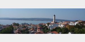
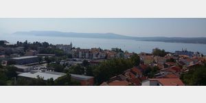
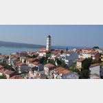
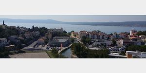
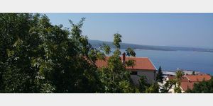
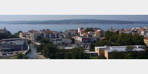
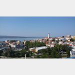
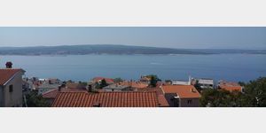
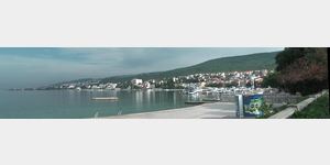
Crikvenica
/
ADDRESS

WeiterUrl : https:/ / de.wikipedia.org/ wiki/ Crikvenica
UrlLoad : https:/ / yes
WikiText : Crikvenica hat einen Sandstrand (kroatisch ,Crni Mol), der durch die Sandanschwemmungen entstanden ist. Den Namen hat die Stadt nach der Kirche (kroatisch ,crkva) des Paulinerklosters erhalten, welches 1412 errichtet wurde. Im Jahre 1891 wurde das erste Hotel in Crikvenica eröffnet. Ein Jahrzehnt später wurde Crikvenica offiziell zum Luftkurort erklärt.
Click for interactive map
..
Pictures of the Poi and surroundings
Videos about the Poi and the surrounding area
.
.
Things to see in the area
Crkva sv. Antona
45.17475,14.69137[ click for more information ]
Elektro-Ladstation
[ click for more information ]Konzum
[ click for more information ]dm
[ click for more information ]Ulica Ivana Skomer%u017Ee
[ click for more information ]Crkva Uznesenja Bla%u017Eene Djevice Marije
45.17147,14.69397[ click for more information ]
Dubracina
45.17549,14.69584[ click for more information ]
Lokvisca
45.15265,14.67102[ click for more information ]
Selce
 Selce is a popular resort town in the Kvarner Bay right on the Croatian Adriatic coast.
 [ click for more information ]
FKK Selce
At the southern end of Selce, between the Selce Autocamp and the Old Sailer House, behind the parking lot is a stairway leading to the coastal path.[ click for more information ]