GIS24.net
Geographic Information System
POI database from MEINWOMOmaps


Geographic Information System
POI database from MEINWOMOmaps
Rheidt
/
ADDRESS
53859 Niederkassel, RheidtPastor-Ibach-Straße
WeiterUrl : https:/ / de.wikipedia.org/ wiki/ Rheidt
UrlLoad : https:/ / yes
WikiText : Rheidt ist ein südlicher Stadtteil von Niederkassel im nordrhein-westfälischen Rhein-Sieg-Kreis. Der Ort liegt am Rhein zwischen Stadtmitte und Mondorf. Hier leben etwas über 10.700 Personen. Rheidt verfügt über zwei Grundschulen, zwei Kindergärten und eine Feuerwehrwache. Am Rheinufer liegt die Halbinsel Rheidter Werth mit Grünanlagen. Sehenswert ist unter anderem die katholische Kirche St. Dionysius. Rheidt wurde 832 erstmalig als Reide erwähnt.
Click for interactive map
..
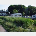
Pictures of the Poi and surroundings
.
Things to see in the area
Rheydter Werth Schule
Rheydter Werth School Niederkassel[ click for more information ]
Katholische Pfarrkirche St.Dionysius
Catholic parish church of St.[ click for more information ]
Netto
Net market Niederkassel[ click for more information ]
Bootsanleger Hersel
 Parking lot intended primarily for boat trailer parking.
 [ click for more information ]
Ursulinenschule Hersel
Ursuline School Hersel Bornheim[ click for more information ]
Edeka
Edeka market in Bornheim[ click for more information ]
Spargelhof Sass
Here asparagus can be bought during the harvest season.[ click for more information ]
Aldi
Supermarket Aldi South[ click for more information ]
sonstiges
Gas station Niederkassel[ click for more information ]
St.Matthäus
St.[ click for more information ]
sonstiges
ED petrol station Bornheim[ click for more information ]
Baggersee
Herseler See Bornheim[ click for more information ]
Shell
Shell gas station Bonn[ click for more information ]
Penny
Penny Market Bonn[ click for more information ]
Siegmündung
The Sieg rises near Walpersdorf in the Rothaargebirge.[ click for more information ]
sonstiges
Fiat Auto Greuel GmbH & Co KG Chr.[ click for more information ]