GIS24.net
Geographic Information System
POI database from MEINWOMOmaps


Geographic Information System
POI database from MEINWOMOmaps
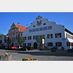
Kelheim
/
ADDRESS
93346 Kelheim, HohenpfahlWeiterUrl : https:/ / de.wikipedia.org/ wiki/ Kelheim
UrlLoad : https:/ / yes
WikiText : Kelheim ist die Kreisstadt des gleichnamigen Landkreises im Regierungsbezirk Niederbayern und liegt an Donau und Main-Donau-Kanal zwischen Ingolstadt und Regensburg. Die Stadt liegt am Ausgang des Donaudurchbruchs, also kurz hinter der Stelle, an der die Donau die Fränkische Alb durchquert, unterhalb des Michelsberges, an der Mündung der Altmühl in die Donau. Durch Ausgrabungen kann eine durchgehende Besiedelung der Umgebung seit dem Neandertaler nachgewiesen werden. Im Stadtgebiet befinden sich bronzezeitliche Grab- und Siedlungsfunde (etwa 2.000 v. Chr.), ein bedeutendes Urnengräberfeld (etwa 800 v. Chr.) und hallstattzeitliche Gräberfelder. Zwischen dem dritten und ersten vorchristlichen Jahrhundert befand sich auf dem Michelsberg ein spätkeltisches Oppidum namens Alkimoennis. Mit einer Fläche von 650 Hektar war es das Zweitgrößte im Süden Deutschlands. Ebenso gibt es Funde aus der Römerzeit und Ausgrabungen einer bajuwarischen Siedlung (etwa 600 n. Chr.).
Click for interactive map
..
Pictures of the Poi and surroundings
Videos about the Poi and the surrounding area
.


.
Things to see in the area
Franziskaner Kirche
 In the years 1461 to 1471 it was built from the remains of the ducal Meierhof as a monastery church for the Franciscans.
 [ click for more information ]
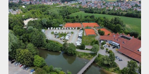
Hotel Seitz
 Parking space in the hotel courtyard, in a quiet location on the edge of the forest.
 [ click for more information ]
Ristorante-Pizzeria La Bella Vita
nice restaurant[ click for more information ]
hafen
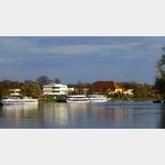 passenger shipping
 [ click for more information ]
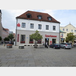
Sparkasse
 Sparkasse Kelheim, Ludwigsplatz
[ click for more information ]
TouristInfo
 Opening hours May to October Monday to Friday: 09:30 to 18:30, Saturday: 10:00 to 12:00 and 13:30 to 17:30, Sunday, public holidays: 10:00 to 12:00 November to April Monday to Friday: 10am to 12pm and 2pm to 5pm
[ click for more information ]
Befreiungshalle Kelheim
 The Liberation Hall is a monument high above the city of Kelheim an der Donau on the Michelsberg.
 [ click for more information ]
Weisses Bräuhaus / Schneider Weisse Biergarten
 Beautiful beer garden of the Weisses Bräuhaus brewery, better known as the maker of the diverse and great-tasting Schneider Weisse beer.
 [ click for more information ]
Weisses Brauhaus
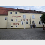 White brewery.
 [ click for more information ]
Stadtpfarrkirche Mariä Himmelfahrt
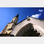 Stadtpfarrkirche Mariä Himmelfahrt The church in the neo-Gothic style was built in the middle of the 15th century.
 [ click for more information ]
Parkplatz Kelheim
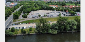 Especially when the real parking space in Kehlheim is full, this space is often used, which can also be seen on Google Earth.
 [ click for more information ]
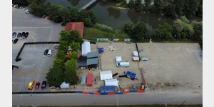
Wohnmobilstellplatz Kelheim
 In contrast to the old parking space at the festival site, the new site is open all year round and does not have to be closed for festivals
is open 1 January - 31 December
[ click for more information ]
Wohnmobilstellplatz am Volksfestplatz
 separate place for mobile homes on the back of the fairground
is open January - December
[ click for more information ]
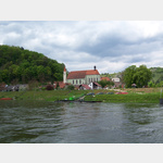
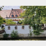
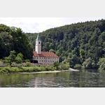
KLÖSTERL
 The Klösterl in Kelheim, Germany, is a former hermitage and a popular excursion destination in the Weltenburger Enge nature reserve.
 [ click for more information ]
Parkplatz Mitterfeldstraße
 Parking lot at Keltenschanze, also suitable for overnight stays.
 [ click for more information ]
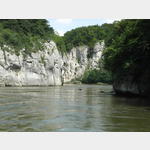
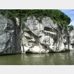
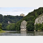
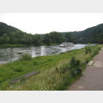
Donaudurchbruch
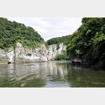 Also called the Weltenburger Narrows.
 [ click for more information ]
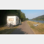
Wohnmobilparkpaltz Hienheimer Forst
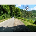 Opposite the Weltenburg monastery there are a few parking bays on the road that are also suitable for an overnight stay.
 [ click for more information ]
Kloster Weltenburg
 The Benedictine Abbey of Weltenburg is located above the Danube Gorge from Kelheim.
 [ click for more information ]