GIS24.net
Geographic Information System
POI database from MEINWOMOmaps


Geographic Information System
POI database from MEINWOMOmaps
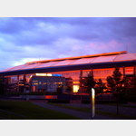
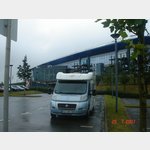
Tankstelle Aral
Fuelstation /
ADDRESS
45891 Gelsenkirchen, ErleCranger Straße
Click for interactive map
..
Pictures of the Poi and surroundings
Videos about the Poi and the surrounding area
.
.
Things to see in the area
Gelsenkirchen, documentation site Gelsenkirchen under National Socialism
[ click for more information ]
[ click for more information ]
Gelsenkirchen, documentation site Gelsenkirchen under National Socialism
[ click for more information ]
[ click for more information ]
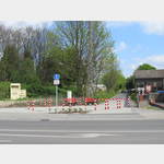
Parkplatz
Parking lot Resser Mark Eckresse[ click for more information ]
Formerly Mobilcamp Gelsenkirchen
 the former pitch is closed, the area can still be used as a parking lot
 is open January - December
[ click for more information ]
Parkplatz
Parking lot Resser Mark Eckresse[ click for more information ]
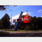
sonstiges
Westphalia petrol station Eckresse[ click for more information ]
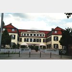
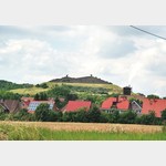
Schloß Berge
Berge Castle Built as a moated castle to protect what is now Gelsenkirchen´s Erle district.[ click for more information ]
Feuerwache 3
Fire station 3 Gelsenkirchen-Eckeresse[ click for more information ]
Aral
Gas station Aral Gelsenkirchen, Vom-Stein-Strasse 40[ click for more information ]
Aral
Gas station Aral Gelsenkirchen Kurt-Schumacher-Strasse 155[ click for more information ]
Kunstmuseum Gelsenkirchen
Permanent exhibition Kinetic artworks Worth seeing, free admission Many objects can be activated by the visitor .[ click for more information ]
Aldi
Aldi store Gelsenkirchen-Buer[ click for more information ]
Aral
Gas station Aral Gelsenkirchen Bismarckstr.[ click for more information ]
Sankt Martinus und Johannes kath.
Catholic Church of Saint Martinus and Johannes Herten-Westerholt[ click for more information ]
Netto
Net market Gelsemkirchen-Buer[ click for more information ]
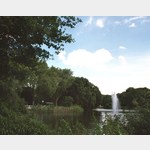
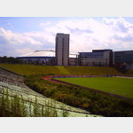
Halde Rungenberg in Gelsenkirchen
 The Rungenberg dump in Gelsenkirchen-Buer, Germany, is a former mine dump that has now been converted into a local recreation and leisure park.
 [ click for more information ]
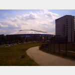
Radweg Zechenbahn Hoheward-Westerholt
 The Regionalverband Ruhr (RVR) is currently laying a cycle path on the disused colliery line from the Ewald mine to the Westerholt mine.
 [ click for more information ]