GIS24.net
Geographic Information System
POI database from MEINWOMOmaps


Geographic Information System
POI database from MEINWOMOmaps
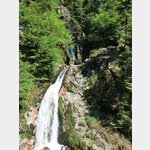
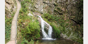
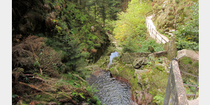
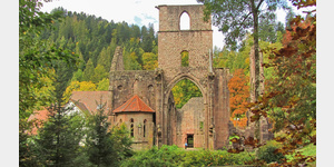
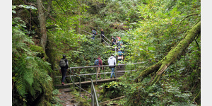
Allerheiligen Wasserfälle
Sight / waterfall
The All Saints Waterfalls overcome a height difference of approx. 90m in several stages. After it has rained, they are of course much more spectacular! In combination with a visit to the monastery ruins, the beer garden by the restaurant, the vantage points above the waterfall, this results in a nice little circular hike of 1 to 2 hours: Monastery - Engelskanzel - Sagenrundweg - Lorenz fountain - Rossgrundhütte - lower car park - through the falls to the monastery. The hike is also suitable for children! You can park below the falls. When the weather is good, the parking lot is often full. A few kilometers uphill by car you will find the significantly more numerous parking spaces of the Allerheiligen monastery. Also note the Wikipedia POI or look directly at Wikipedia:https://de. wikipedia. org/wiki/All Saints Waterfalls
ADDRESS
77728 OppenauAllerheiligenstraße
Click for interactive map
..
Pictures of the Poi and surroundings
Videos about the Poi and the surrounding area
.


.
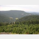
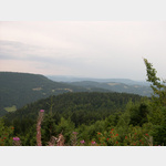
Things to see in the area
Sagenrundweg Allerheiligen Wasserfälle und Klosterruine
Beautiful circular hiking trail through the waterfalls and past the monastery.[ click for more information ]
ParkenPkw
Parking at the K5370, Black Forest North/Central, Germany[ click for more information ]
Day car park Allerheiligen
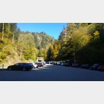 To visit the monastery ruins and waterfalls
usable January - December
[ click for more information ]
Wanderparkplatz St. Ursula
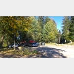 There are a few flat places available ,?
is open January - December
[ click for more information ]
Kloster Allerheiligen
Visitors mainly hikers and tourists[ click for more information ]
Am hirschkopf
 Schliffkopf car park on the K5370 in the direction of travel Kloster Allerheiligen, Germany
 [ click for more information ]
ParkenPkw
Lierbachstraße car park on the K5370 in the direction of Lierbach, Black Forest North/Central, Germany[ click for more information ]
Wanderparkplatz Schliffkopf
 Schön und Aussichtsreich etwas abseits der B500 gelegen.
 [ click for more information ]
Edelfrauengrab-Wasserfall
 Noblewoman´s Grave Waterfall In the noblewoman´s water grave, a noble woman found her wet death, according to legend.
 [ click for more information ]
ParkenPkw
Allerheiligenstrasse car park on the K5370 in the direction of the B500, Germany[ click for more information ]
Wanderparkplatz Lotharpfad
Lothar path/2020-07-27[ click for more information ]
Lotharpfad
The Lotharpfad is a forest adventure and educational trail in the Schliffkopf nature reserve.[ click for more information ]
Bosensteiner Almpfad
Black Forest Adventure Trails Length about 9km[ click for more information ]
Burg Bosenstein
The ´Hagenburger Schloss´ is a ruin at 400m above sea level in the 11th century.[ click for more information ]
Nationalpark Schwarzwald - Informationszentrum
Information center of the Black Forest National Park, founded in 2014.[ click for more information ]
Erlebnisbad Ottenhöfen
Natural adventure pool with children´s pool, a sunbathing lawn with beach chairs and a rafting route daily from 9 a.m.[ click for more information ]
Parkplatz am Bahnhof
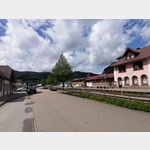 Update 2023: According to a notice from the municipality, this space may no longer be used for mobile homes A parking space at the head railway station.
 [ click for more information ]
Darmstädter Hütte
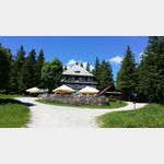 The Darmstädter Hütte is a ski and hiking hut on the Ruhestein at 1030 m above sea level.
 [ click for more information ]