GIS24.net
Geographic Information System
POI database from MEINWOMOmaps


Geographic Information System
POI database from MEINWOMOmaps
Urzeitwald
Veranstaltungsort / Erlebnispark
The development of our earth is brought closer in the family adventure park. 16 stations promise fun and the highlight is of course the flight on a pterosaur.
The park is open daily from 10am to 6pm (late May to early September)
ADDRESS
 4825 Gosau
Gosausee Bezirksstraße
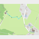
Click for interactive map
..
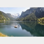
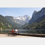
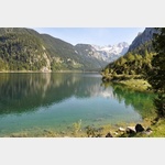
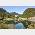
Pictures of the Poi and surroundings
Videos about the Poi and the surrounding area
.

Routes and books with this POI
Österreich, Salzburg und Salzkammergut
.
Things to see in the area
bergbahn
Panorama-JET-Zwieselalm The lift needs a little more than 6 minutes to overcome a height difference of 767m.[ click for more information ]
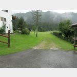
Gasthaus Echo
 Large space on the right in the meadow.
 [ click for more information ]
Parkplatz bei/im Restaurant/Hotel/Weingut
 Gasthof Gosauschmied KG
is open January - December
[ click for more information ]
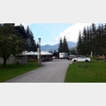
Wohnmobilparkplatz Gosausee P3
 Motorhome suitable parking place just before the Gosausee (popular hiking destination in the region)
is usable 1 January - 31 December
[ click for more information ]
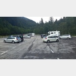
Wohnmobilparkpplatz Gosausee P1
Large car park in front of the Gosauseeopen 1 January - 31 December
[ click for more information ]
SalzAlpenSteig 16, Gablonzer Hütte - Gosau
SalzAlpenSteig The hiking trail leads over 233 km from Lake Chiemsee to the Dachstein.[ click for more information ]
Kleiner Donnerkogel
Small Donnerkogel 1916m[ click for more information ]
SalzAlpenTour - Gosau - Dachstein
SalzAlpenTour - Gosau - Dachstein Length: 5.21 km Highest point: 1028 m Lowest point: 752 m[ click for more information ]
Kreuzweg Gosau
 The four Way of the Cross chapels, built in 1775, are located on the stairway to Calvary.
 [ click for more information ]
SalzAlpenSteig 17, Gosau - Bad Goisern
SalzAlpenSteig The hiking trail leads over 233 km from Lake Chiemsee to the Dachstein.[ click for more information ]
Grosswand
Large wall 2415m[ click for more information ]
Brett Kogel
Brett Kogel 1838m[ click for more information ]
Berghuette
Theodor-Körner-Hütte 1466m https://huetten.[ click for more information ]
SalzAlpenTour - Stuhlloch - Annaberg
Length: 12.87 km Highest point: 1648 m Lowest point: 988 m[ click for more information ]