GIS24.net
Geographic Information System
POI database from MEINWOMOmaps


Geographic Information System
POI database from MEINWOMOmaps
Wiener Pforte
/
ADDRESS
 3400 Gemeinde Klosterneuburg
Dammweg
WeiterUrl : https:/ / de.wikipedia.org/ wiki/ Wiener Pforte
UrlLoad : https:/ / yes
WikiText : Wiener Pforte ist die Bezeichnung des Durchbruchs der Donau vom Rand des Wienerwaldes in die Ebene des Wiener Beckens. Die Pforte liegt am Nordwestrand von Wien und wird gebildet vom steilen Leopoldsberg (425 m) am rechten und dem Bisamberg (358 m) am linken Donauufer. Unweit verläuft auch die Grenze zwischen den niederösterreichischen Gemeinden Klosterneuburg und Langenzersdorf. Die Wiener Pforte entstand vor etwa 350.000 Jahren durch Erosion der Donau entlang einer geologischen Bruchlinie zwischen Wienerwald und Bisamberg. Vermutet wird, dass auch der Kierling- und der Weidlingbach einen merklichen Einfluss beim Entstehen des Durchbruches hatten.
Click for interactive map
..
Pictures of the place and surroundings
Videos about the Poi and the surrounding area
.


.
Interesting places in the area
Essl Museum
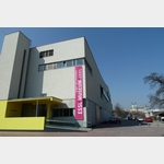 Karlheinz and Agnes Essl started collecting in the late 1950s.
 [ click for more information ]
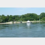
Parkplatz am Beginn der Donauinsel
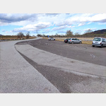 The car park at the beginning of the Danube Island is not in the Vienna city limits.
 [ click for more information ]
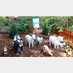
Happyland Klosterneuburg
Das Happyland ist ganzjährig geöffnet und bietet auf rund 100.[ click for more information ]
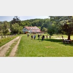
Camping Klosterneuburg
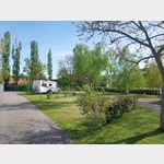 A campsite on a 2, 2ha site with a plot size of 80-100sqm per plot
is usable 30 March - 16 November
[ click for more information ]
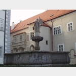
Stift Klosterneuburg
 A gust of wind carried the bridal veil of the wife Leopold III.
 [ click for more information ]
Rollfähre Klosterneuburg
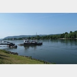 The Klosterneuburg roller ferry is the only way to cross the Danube for motor vehicles between the Tulln Danube Bridge and the Vienna North Bridge.
 [ click for more information ]
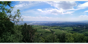
Kahlenberg
Kahlenberg 484m[ click for more information ]
Hofer
Hofer, Langenzersdorf Meisengasse, Langenzersdorf, Austria[ click for more information ]
Stephaniewarte
 A 22 m high tower on the 484 m high Kahlenberg
[ click for more information ]
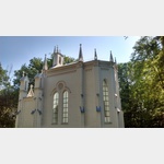
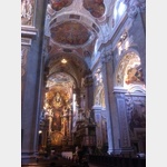
St.Josefskirche
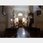 In 1629, the Camaldolese began building the monastery church on the Kahlenberg (484m), the most popular mountain for the Viennese.
 [ click for more information ]
Kreuzweg Bisamberg
It is based on the sacred staircase and includes the stations from ´Farewell to the mother´ to ´Crucifixion´.[ click for more information ]
Bahnhof
Train station - Korneuburg[ click for more information ]
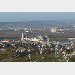
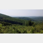
Aussichtspunkt
Höhenstrasse with great views of Vienna.[ click for more information ]
Picknickbank
Picnic bench with a fabulous view of the valley[ click for more information ]
Radtour entlang der Donau
 Approx.
 [ click for more information ]