GIS24.net
Geographic Information System
POI database from MEINWOMOmaps


Geographic Information System
POI database from MEINWOMOmaps
Europahütte
/
ADDRESS

WeiterUrl : https:/ / de.wikipedia.org/ wiki/ Europahütte
UrlLoad : https:/ / yes
WikiText : p1 p2 Die Europahütte ist eine Schweizer Berghütte auf der Westseite des Mischabelmassivs. Sie liegt oberhalb von Randa und unterhalb vom Dom auf eine Höhe von 2220 ,m ,ü. ,M.. Sie befindet sich an der Kreuzung des Domhüttenweges und des Europawegs und ist ein wichtiger Stützpunkt dieses Höhenwanderwegs. Sie wurde von 1998 bis 1999 gebaut und gehört der Gemeinde Randa. Sie wird nur im Sommer bewirtschaftet und hat keinen Winterraum.
Click for interactive map
..
Pictures of the Poi and surroundings
.
Things to see in the area
Europahütte
Europahütte is located above Randa at 2265m, in the middle of a larch forest.[ click for more information ]
Domhütte
The Domhütte is located in the Swiss canton of Valais in the Mischabel group of the Valais Alps at 2940 m above sea level.[ click for more information ]
Kinhütte
The Kinhütte is located in the canton of Valais in the Mattertal and is at an altitude of 2584 meters in the midst of the four-thousanders of the Mischabel Group.[ click for more information ]
Kirche St. Sebastian
[ click for more information ]Raiffeisen Randa
[ click for more information ]Parkenprivat
[ click for more information ]Parkenwander
[ click for more information ]Kapelle Wildi
[ click for more information ]Fuxsteinkapelle
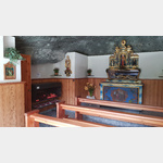 at the far right edge of the campsite is the chapel built into the rock with the entrance towards Zermatt
[ click for more information ]
Bordierhütte
Approach: From Gasenried or Grächen to the Bordierhütte (2886 m above sea level)[ click for more information ]