GIS24.net
Geographic Information System
POI database from MEINWOMOmaps


Geographic Information System
POI database from MEINWOMOmaps
Moserjosl
/
ADDRESS
 8524 Gemeinde Freiland bei Deutschlandsberg
Freilandstraße
WeiterUrl : https:/ / de.wikipedia.org/ wiki/ Schwarzkogel
UrlLoad : https:/ / yes
WikiText : Gipfel des Schwarzkogels vom Stoffkogel aus Der Schwarzkogel ist ein Berg in der mittleren Koralpe in der Steiermark, sterreich. Der Schwarzkogel ist der höchste Punkt eines nordwest-südöstlich verlaufenden Höhenrückens. Dieser Rücken beginnt mit einem Vorberg, der im alltäglichen Sprachgebrauch des Gebietes Blochriegel genannt wird, aber auf den Landkarten als Hochriegel ausgewiesen ist (1440 ,m Seehöhe) und dem Gebiet des Filzmooses auf der Freiländer Alm im Hebalmgebiet. Er bildet die Wasserscheide zwischen Rettenbach bzw. Laßnitz einerseits und Wildbach andererseits. In diese Flüsse münden südlich der Gratzenbach und nördlich der Klosterbach.
Click for interactive map
..
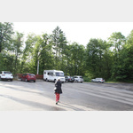
Pictures of the Poi and surroundings
.
Things to see in the area
Schloss Wildbach
[ click for more information ]Parkplatz Burg Deutschlandsberg
 If it is too narrow or too dark on the official parking space below at the Koralmhalle, you will find an airy spot with a wide view in the large parking lot in front of the castle
open January - December
[ click for more information ]
Archeo Norico - Burgmuseum Deutschlandsberg
[ click for more information ]Burg Deutschlandsberg
[ click for more information ]Schloß Feilhofen
[ click for more information ]Einkaufsparkplatz
[ click for more information ]Billa
[ click for more information ]Billa Plus
[ click for more information ]Elektro-Ladstation
[ click for more information ]Apotheke
[ click for more information ]Stainzer Warte
The 25 m high tower stands on the 608 m high Lethkogel.[ click for more information ]