GIS24.net
Geographic Information System
POI database from MEINWOMOmaps


Geographic Information System
POI database from MEINWOMOmaps
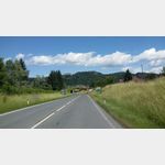
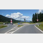
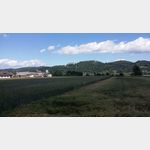
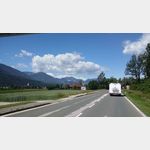
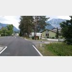
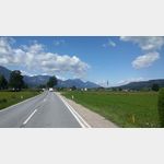
Kirschentheuer
/
ADDRESS
 9170 Gemeinde Ferlach
B85
WeiterUrl : https:/ / de.wikipedia.org/ wiki/ Kirschentheuer
UrlLoad : https:/ / yes
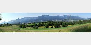
WikiText : Kirschentheuer (slowenisch: Koentavra) ist ein Dorf mit 250 Einwohnern und Katastralgemeinde der Gemeinde Ferlach im Süden von Kärnten. Sie liegt am nördlichen Abhang der Karawanken, welche die österreichische Staatsgrenze zu Slowenien bilden. Kirschentheuer ist der wichtigste Kreuzungspunkt im Rosental (Kreuzung der wichtigen Verkehrsrouten Loiblpass Straße B ,91 und der Rosental Straße B ,85). Die nächstgelegene Stadt ist die drei Kilometer östlich gelegene Büchsenmacherstadt Ferlach. Die Kärntner Landeshauptstadt Klagenfurt liegt 13 ,km nördlich von Kirschentheuer und ist über die Bundesstraße 91 zu erreichen. Der von Kirschentheuer aus sichtbare Teil der Karawanken wird vom Ferlacher Horn (1.850 ,m) und, an dessen Ostflanke, dem Sechter (1449 ,m) dominiert. stlich des Sechters ist ein Teil der Koschuta (2.066 ,m) und der Matzen (1.627 ,m) zu sehen. In direkter Blickrichtung nach Osten kann man das Obirmassiv, bestehend aus Kleinobir (1.948 ,m) und Hochobir (2.142 ,m) erkennen. Die sich am äußersten östlichen Ende der Karawanken befindliche Petzen (2.126 ,m) ist nur an klaren Tagen zu beobachten. Westlich des Ferlacher Horns liegt der Hausberg Kirschentheuers, der Singerberg (1.589 ,m), an welchem von Windisch Bleiberg aus vom 14. bis 20. Jahrhundert Zinn- und Bleierz abgebaut wurde. Vom Singerberg aus zieht sich das Karawankenmassiv, mit dem Mittagskogel (2.145 ,m), bis nach Arnoldstein.
Click for interactive map
..
Pictures of the Poi and surroundings
Videos about the Poi and the surrounding area
.
.
Things to see in the area
sonstiges
Mazda Mazda dealers and workshops Kirschentheuer 60 A-9162 Strau near Ferlach[ click for more information ]
Burg Hollenburg
The Hollenburg is located on the B91 of the Loiblpass federal road.[ click for more information ]
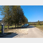
Rastplatz Unterchlossberg
Unterchleissberg rest area[ click for more information ]
Gasthof Singer Hausmanskost 43 4227 840 20
[ click for more information ]
[ click for more information ]
Ressnig-Teich
The lake, which has an average depth of 6 and a maximum of 10 meters, is fed exclusively by groundwater.[ click for more information ]
Ferlacher Bahn
With the museum railway from Weizelsdorf to Ferlach.[ click for more information ]
Parkplatz Strandbad Ressnig
 Parking at the bathing lake.
 [ click for more information ]
Apotheke
Karawanken-Apotheke 9170 Ferlach, Klagenfurter Straße 44 T: 43 (0)4227 286 00[ click for more information ]
Billa
Supermarket -BILLA- AT|Carinthia|Ferlach|9170|Waagstrasse 4, 9170 Ferlach, Austria[ click for more information ]
Billa
Billa grocery store[ click for more information ]
Kirschnerhof The regional cuisine is very important to us.
[ click for more information ]
[ click for more information ]
Volksbank Wanderweg
Trail on solid ground.[ click for more information ]
Technikmuseum Historama Ferlach
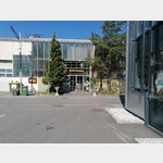 vehicles of all kinds
[ click for more information ]
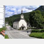 Church AT|Carinthia|Ferlach||Unterloibl 37, 9163 Ferlach, Austria
[ click for more information ]
Parkplatz Tscheppaschlucht
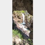 The car park is a good starting point for a paid visit to the gorge.
 [ click for more information ]
Karavankenblick
 From the parking lot, the panorama of the Karavanke is in front of the viewer.
 [ click for more information ]