GIS24.net
Geographic Information System
POI database from MEINWOMOmaps


Geographic Information System
POI database from MEINWOMOmaps
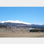
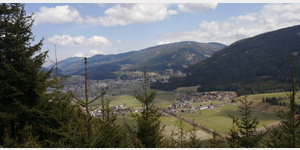
Unternberg
/
ADDRESS
 5585 Gemeinde Unternberg
Murtal Straße
WeiterUrl : https:/ / de.wikipedia.org/ wiki/ Unternberg
UrlLoad : https:/ / yes
WikiText : Unternberg ist eine der 15 Gemeinden im Bezirk Lungau, Salzburg in sterreich. Das Gemeindegebiet der Gemeinde Unternberg besteht aus den Katastralgemeinden Unternberg, Voidersdorf, Neggerndorf, Flatschach, Spitzing, Stranach, Pischelsdorf, Pichlern und Katzlau. Das Wappen der Gemeinde ist: "In schwarzem Schild ein schmaler silberner Wellenbalken, begleitet oben von einer goldenen Krone, rechts und links davon je eine goldene Kugel, unten von den gekreuzten goldenen Schlägel und Eisen, beide oben eine goldene Kugel einschließend."
Click for interactive map
..
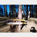
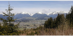
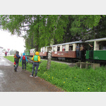
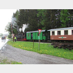
Pictures of the Poi and surroundings
Videos about the Poi and the surrounding area
.
.
Things to see in the area
Mitterberg
[ click for more information ]Burgruine Pichl
[ click for more information ]Schloss Moosham
[ click for more information ]Billa
[ click for more information ]Billa Parkplatz
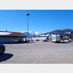 Parking at the Billa supermarket
[ click for more information ]
Zwei Mühlsteine
[ click for more information ]Glocke
[ click for more information ]Wanderung auf den Mitterberg, Hohenbühel
The start and finish of the tour is the hiking car park at Passeggen.[ click for more information ]
Mountainbike - Leißnitzroute
The route leads from St.[ click for more information ]
Wanderparkplatz Leißnitzgraben
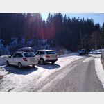 This car park is only accessible for cars, can be used as a hiker´s car park (Bonnerhütte)
[ click for more information ]