GIS24.net
Geographic Information System
POI database from MEINWOMOmaps


Geographic Information System
POI database from MEINWOMOmaps
Mýtina
/
ADDRESS

WeiterUrl : https:/ / de.wikipedia.org/ wiki/ Mýtina
UrlLoad : https:/ / yes
WikiText : Mtina (deutsch Altalbenreuth) ist ein Ortsteil von Lipov¡ im Okres Cheb in Tschechien. Mtina befindet sich etwa 13 Kilometer südöstlich von Cheb in der Nähe der deutschen Grenze in den Vorbergen des Tillenberger Walds. Entstanden ist das Dorf in der Frais im 14. Jahrhundert. In der Nähe befand sich eine Festung, die später jedoch zerfiel. Noch vor dem Zweiten Weltkrieg lebten im Dorf über 800 Menschen, fast ausschließlich Deutsche.
Click for interactive map
..
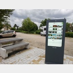
Pictures of the Poi and surroundings
.
Things to see in the area
Eisenbühl
2177737_Beschreibung[ click for more information ]
Muzeum Skanzen Doubrava
[ click for more information ]Palicsky mlyn
[ click for more information ]Grenzlandheimatstuben und Sengerhof
[ click for more information ]Sagenbrunnen mit Märchenmotiven aus dem Umland
[ click for more information ]Parkplatz
 Easy parking space for self-sufficient mobile homes
is open 1 January - 31 December
[ click for more information ]
Mini Golf
Minigolf parlor Neualbenreuth[ click for more information ]
Grenzlandturm
The 19 m high tower was inaugurated in 1961.[ click for more information ]
Sibyllenbad
Drinking fountain with medicinal water from the Sibyllenquelle physical therapy with baths and fango department, thermal baths also for cardiovascular patients[ click for more information ]
Wallfahrtskirche Maria Loreto
The church was built by Jesuits in 1664.[ click for more information ]
Kreuzweg Maria Loreto
The original Way of the Cross led from Podhrad, a district of Cheb, through a landscape that was difficult to access to the pilgrimage church.[ click for more information ]