GIS24.net
Geographic Information System
POI database from MEINWOMOmaps


Geographic Information System
POI database from MEINWOMOmaps
Chandolin
/
ADDRESS

WeiterUrl : https:/ / de.wikipedia.org/ wiki/ Chandolin
UrlLoad : https:/ / yes
WikiText : Chandolin war bis zum 31. Dezember 2008 eine politische Gemeinde im Val dAnniviers, Bezirk Sierre des Kantons Wallis in der Schweiz. Auf den 1. Januar 2009 hat Chandolin mit übrigen fünf Gemeinden des Tals (Ayer, Grimentz, Saint-Jean, Saint-Luc und Vissoie) zur Gemeinde Anniviers fusioniert. Neben dem alten Haufendorf Chandolin wächst seit 1950 eine touristische Streusiedlung.
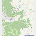
Click for interactive map
..
Pictures of the Poi and surroundings
.
Things to see in the area
ParkenAll
[ click for more information ]La Cabane Illhorn
The hut is located in the Val d´Anniviers at 2147m.[ click for more information ]
Elektro
[ click for more information ]Parkenwander
[ click for more information ]Pas de lIllsee
The Pas de l´Illsee is a 2,544 m high mule pass between the municipalities of Leuk in the Rhone Valley and Anniviers.[ click for more information ]
Cabane Bella Tola
The hut is located at Chandolin at 2340m.[ click for more information ]
Planetenweg St. Luc
 The scale of the planetary models is 1:100.
 [ click for more information ]
Planetenweg Saint Luc
From the sun to Pluto[ click for more information ]
Les Moulins de St-Luc
The Mills of St-Luc are a fine example of a 16th century industrial site.[ click for more information ]
Musée des patoisants et costumes
The collections present various farming utensils and tools.[ click for more information ]