GIS24.net
Geographic Information System
POI database from MEINWOMOmaps


Geographic Information System
POI database from MEINWOMOmaps
Les Moëres
/
ADDRESS
59122 Les MoëresRoute de Bray-les-Dunes
WeiterUrl : https:/ / de.wikipedia.org/ wiki/ Les Moëres
UrlLoad : https:/ / yes
WikiText : Les Mores (niederländisch: De Moeren) ist eine Gemeinde in Nord-Frankreich, nahe Dünkirchen mit 391 Einwohnern (1999). Sie gehört zum Dpartement Nord. Die östliche Gemeindegrenze stellt gleichzeitig die Staatsgrenze zu Belgien dar. Bambecque | Ghyvelde | Hondschoote | Killem | Les Mores | Oost-Cappel | Rexpode | Warhem
Click for interactive map
..
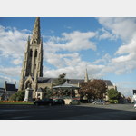
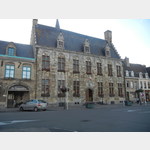
Pictures of the Poi and surroundings

.