GIS24.net
Geographic Information System
POI database from MEINWOMOmaps


Geographic Information System
POI database from MEINWOMOmaps
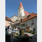
Weißenkirchen in der Wachau
/
ADDRESS
 3610 Gemeinde Rossatz-Arnsdorf
B33
WeiterUrl : https:/ / de.wikipedia.org/ wiki/ Weißenkirchen in der Wachau
UrlLoad : https:/ / yes
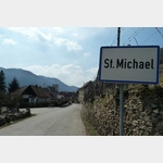
WikiText : Weißenkirchen in der Wachau ist eine Marktgemeinde mit 1.424 Einwohnern im Bezirk Krems-Land in Niederösterreich. Weißenkirchen in der Wachau liegt im Waldviertel in Niederösterreich. Die Fläche der Marktgemeinde umfasst 23,28 Quadratkilometer. 63,06 Prozent der Fläche sind bewaldet. Katastralgemeinden sind Joching, St. Michael, Wösendorf in der Wachau und Weißenkirchen in der Wachau.
Click for interactive map
..
Pictures of the Poi and surroundings
Videos about the Poi and the surrounding area
.

.
Things to see in the area
Seekopfturm
The 11 m high tower has stood on the 671 m high Seekopf since 1993.[ click for more information ]
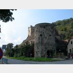
Burgus St. Lorenz
Parts of the burgus are built into the church[ click for more information ]
Donaufähre Weißenkirchen - St.Lorenzen
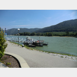 The Danube ferry Weißenkirchen - St.
 [ click for more information ]
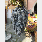
Wachauer Bauernladen
The Wachau farm shop offers epicurean delicacies from the Wachau-Waldviertel region.[ click for more information ]
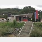
Bahnhof Weissenkirchen
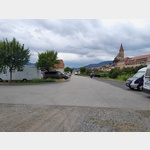 Parking for overnight stays, free of charge
open January - December
[ click for more information ]
Burgos Bacharnsdorf
Roman watchtower, preserved up to a height of 9 m[ click for more information ]
Pfarrkirche St.Michael
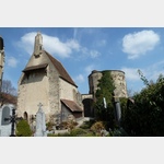 Until the 14th century, the church was the only parish in the Danube valley and for a long time also had the only cemetery in the Wachau.
 [ click for more information ]
Weingut Johannes Glück
Very nice Heuriger in a quiet location.[ click for more information ]
Weiglwarte
On the 723 m high Sandl stands the 16 m high observation tower.[ click for more information ]
Donaufähre Spitz
The Danube ferry Spitz in the municipality of Rossatz-Arnsdorf in Austria connects the two banks of the Danube all year round.[ click for more information ]
WC
 Im Ticketgebäude
[ click for more information ]