GIS24.net
Geographic Information System
POI database from MEINWOMOmaps


Geographic Information System
POI database from MEINWOMOmaps
Sankt Gallenkirch
/
ADDRESS
 6791 St. Gallenkirch
WeiterUrl : https:/ / de.wikipedia.org/ wiki/ Sankt Gallenkirch
UrlLoad : https:/ / yes
WikiText : Sankt Gallenkirch ist eine Gemeinde im österreichischen Bundesland Vorarlberg mit 2.257 Einwohnern (Stand 1. Januar 2008). Die vom Fremdenverkehr geprägte Gemeinde liegt im Bezirk Bludenz und gliedert sich in die Ortsteile St. Gallenkirch, Gargellen und Gortipohl. Sankt Gallenkirch liegt im Süden Vorarlbergs auf 878 ,Metern Höhe. Mit einem Gemeindegebiet von beinahe 128 ,km ist Sankt Gallenkirch die flächenmäßig zweitgrößte Gemeinde des Bundeslandes. 28,1 ,% dieser Fläche sind bewaldet, weitere 47,1 ,% zählen zum hochalpinen Gebiet. Das kleine Bergdorf Gargellen hat etwa 110 Einwohner und liegt auf einer Höhe von 1.423 ,m ,ü. ,A.. Damit ist es der höchstgelegene Ort im Montafon. Der Ort ist stark vom Tourismus geprägt, es gibt eine Vielzahl von Hotels, Pensionen, Privatzimmern und Ferienwohnungen.
Click for interactive map
..
Pictures of the place and surroundings
.
Interesting places in the area
bergbahn
Valley station of the Silvretta NOVA cable cars| Ideal hiking area[ click for more information ]
ParkenMix
Parking at the Silvretta NOVA valley station[ click for more information ]
Friedhof
Cemetery St Gallenkirch[ click for more information ]
Garfrescha Bergstation
T: 43 (0)5557 6300[ click for more information ]
Waldcamping Batmund
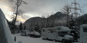 Nice little cozy, family-run campsite
open -
[ click for more information ]
Restaurant Brunella
Very good food and a great place to stop after a hike.[ click for more information ]
Gasthaus Montafonerhüsli
cozy inn with tasty food, regional cuisine.[ click for more information ]
bergbahn
Lift Gargellen|[ click for more information ]
BP
Gas bottle exchange possible[ click for more information ]
Tunnel
Gortniel Tunnel Silvretta Straße L 188[ click for more information ]
Tunnel
Gortniel Tunnel Silvretta Straße L 188[ click for more information ]