GIS24.net
Geographic Information System
POI database from MEINWOMOmaps


Geographic Information System
POI database from MEINWOMOmaps
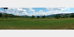
Oberhofen am Irrsee
/
ADDRESS
 4894 Oberhofen am Irrsee
Rabenschwand
WeiterUrl : https:/ / de.wikipedia.org/ wiki/ Oberhofen am Irrsee
UrlLoad : https:/ / yes
WikiText : Oberhofen am Irrsee ist eine Gemeinde in Oberösterreich im Bezirk Vöcklabruck im Hausruckviertel mit 1.436 Einwohnern. Der zuständige Gerichtsbezirk ist Mondsee. Oberhofen am Irrsee liegt auf 573 m Höhe im Hausruckviertel. Die Ausdehnung beträgt von Nord nach Süd 6 km, von West nach Ost 6,7 km. Die Gesamtfläche beträgt 21,2 km. 34, ,% der Fläche sind bewaldet, 59,% der Fläche sind landwirtschaftlich genutzt. Ortsteile der Gemeinde sind: Berg, Fischhof, Gegend, Höhenroith, Haslach, Laiter, Oberhofen am Irrsee, Obernberg, Rabenschwand, Römerhof, Salzweg, Schoibern, Schweibern, Steinbach, Stock, Wegdorf.
Click for interactive map
..
Pictures of the Poi and surroundings
Videos about the Poi and the surrounding area
.
.
Things to see in the area
Irrsberg
[ click for more information ]Filialkirche Irrsdorf
[ click for more information ]Burg Wildenegg
[ click for more information ]Irrsee
4894 Municipality of Oberhofen am Irrsee Fischhof[ click for more information ]
Dr. Mayer-Zuchi
[ click for more information ]FANTASIANA Erlebnispark
[ click for more information ]Irrseer Heimathaus
Exhibited and explained are numerous exhibits on peasant life, craftsmanship and customs.[ click for more information ]
Apotheke
[ click for more information ]Dr. Gruber
[ click for more information ]Pfarrkirche Zell am Moos
The single-nave Gothic church was first mentioned in 1107.[ click for more information ]