GIS24.net
Geographic Information System
POI database from MEINWOMOmaps


Geographic Information System
POI database from MEINWOMOmaps
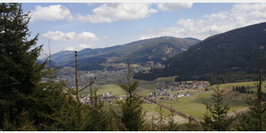
Mariapfarr
/
ADDRESS
 5571 Gemeinde Mariapfarr
Lungau Landesstraße
WeiterUrl : https:/ / de.wikipedia.org/ wiki/ Mariapfarr
UrlLoad : https:/ / yes
WikiText : Mariapfarr (Lungauer Dialekt: Pforch) ist eine der 15 Gemeinden im Bezirk Lungau, Salzburg in sterreich. Die Gemeinde gilt seit vielen Jahren (gemessen an Sonnenstunden) als der sonnenreichste Ort sterreichs. Das Gemeindegebiet der Gemeinde Mariapfarr besteht aus den Katastralgemeinden Mariapfarr, Pichl und Zankwarn. Weitere Dörfer im Gemeindegebiet: Althofen, Bueggen, Bruggarn, Fanning, Grabendorf, Gröbendorf, Kreischaberg, Lignitz, Miesdorf, Niederrain, rmoos, Seitling, Stockerfeld, Taurachweg, Stranach, Tschara.
Click for interactive map
..
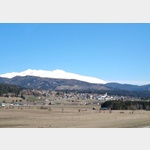
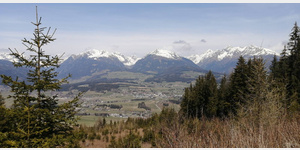
Pictures of the place and surroundings
Videos about the Poi and the surrounding area
.

.
Interesting places in the area
Billa Parkplatz
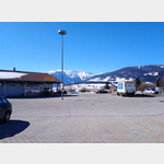 Parking at the Billa supermarket
[ click for more information ]
Billa
[ click for more information ]Joseph-Mohr-Brunnen
[ click for more information ]Pfarr- Wallfahrts- Stille Nacht Museum
[ click for more information ]Wallfahrtsbasilika Mariapfarr
[ click for more information ]Spielplatz
[ click for more information ]Burgruine Pichl
[ click for more information ]Großparkplatz bei den Fanningbergliften
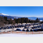 Large car park at the valley station of the Fanningberg lifts, Samsonbahn.
 [ click for more information ]
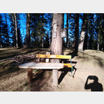
Wanderung auf den Mitterberg, Hohenbühel
The start and finish of the tour is the hiking car park at Passeggen.[ click for more information ]
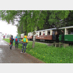
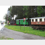
Taurachbahn
With the historical museum railway between Mauterndorf and St. [ click for more information ]